1 ITEMView cart
-
Garmin Descent G1 Slate Gray 1 × AED 2,239.00

Your order qualifies for free shipping!
Subtotal: AED 2,239.00

Subtotal: AED 2,239.00
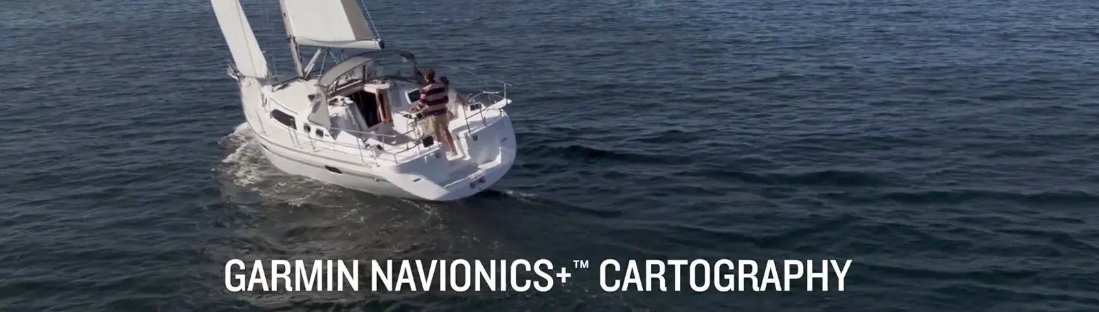
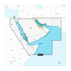
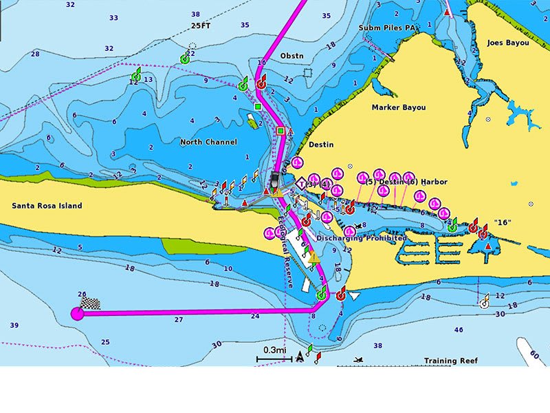
Featuring vibrant colours, a streamlined interface, and combined coastal/inland content with a popular Navionics® style colour palette, Garmin Navionics+ cartography makes it easy to plot your course with the world’s No. 1 name in marine mapping1.

Navigate with our best offshore and inland lake coverage for your Garmin chartplotter.

See it your way. Customise your view with various chart layers and overlay combinations.

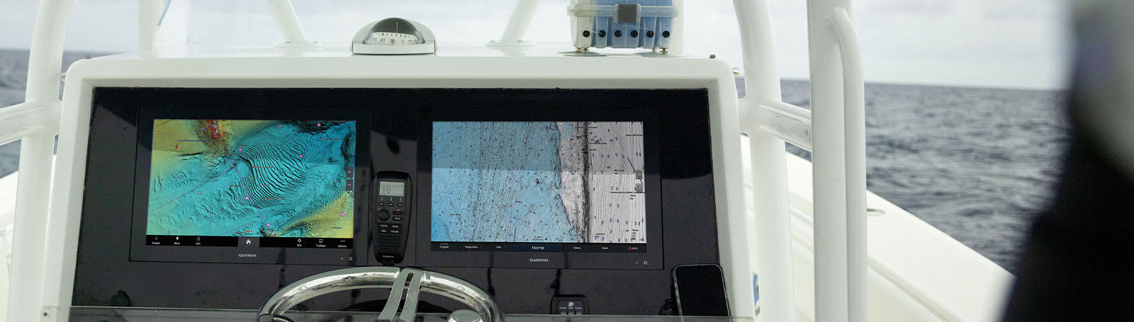
With your included one-year subscription, access daily updates via the ActiveCaptain® smart device app.

Auto Guidance+™ technology2 lets you navigate with suggested dock-to-dock routings.

Select up to 10 colour-shaded target depth ranges to scope out the best fishing spots.

Save money by renewing your subscription — and continue accessing daily updates plus new content downloads.
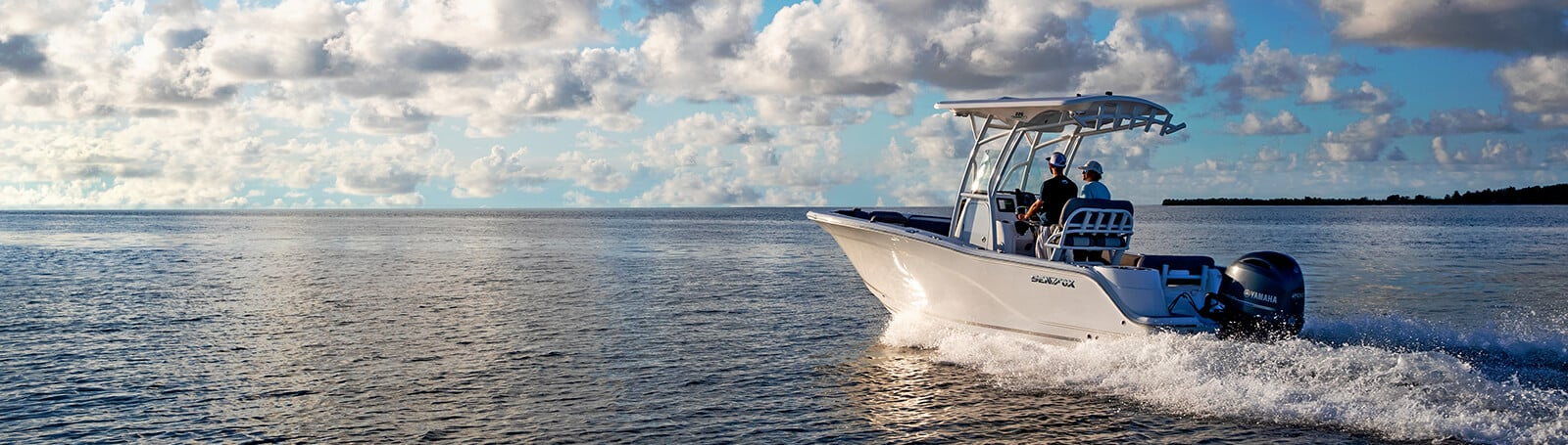
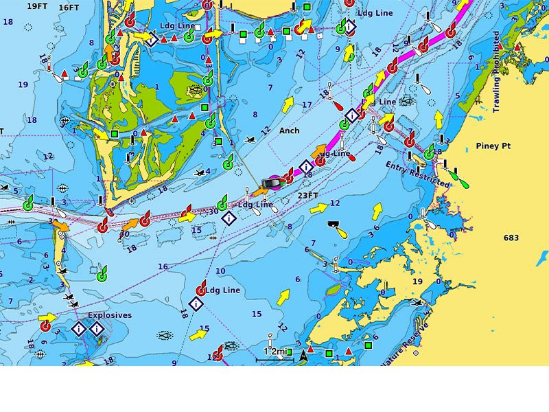
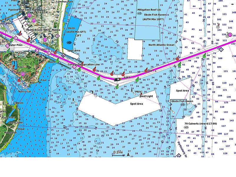
Access detail-rich mapping of coastal features, lakes, rivers and more. Integrated Garmin and Navionics content offers coverage for boaters worldwide.
Charts are constantly being enhanced with new and amended content — Thousands of updates are made every day. The one-year included subscription gives you access to daily chart updates via the ActiveCaptain smart device app.
Combining the best of Garmin and Navionics automatic routing features, built-in Auto Guidance+ technology2 gives you a suggested dock-to-dock path to follow through channels, inlets, marina entrances and more.
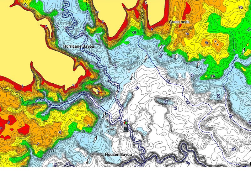
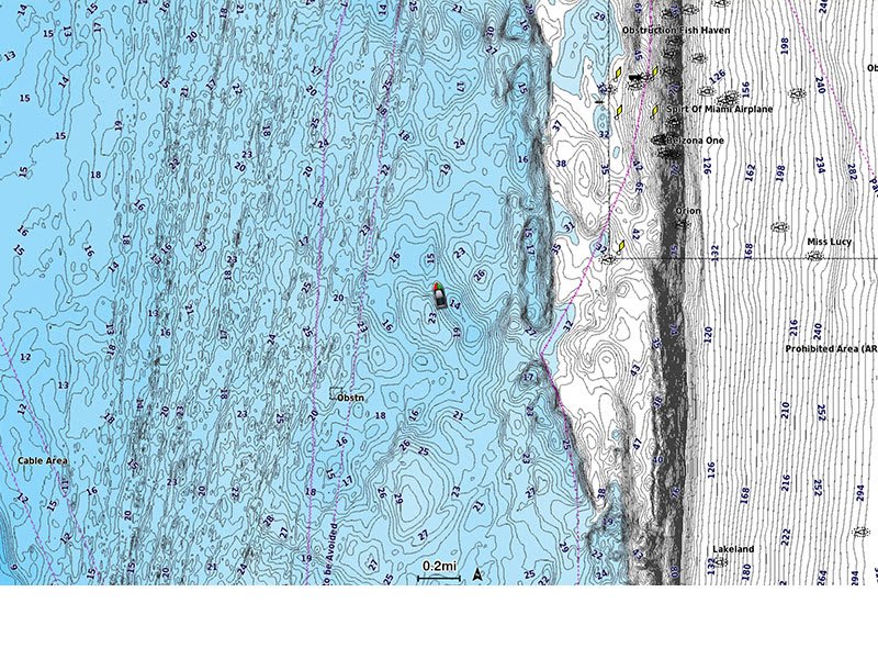
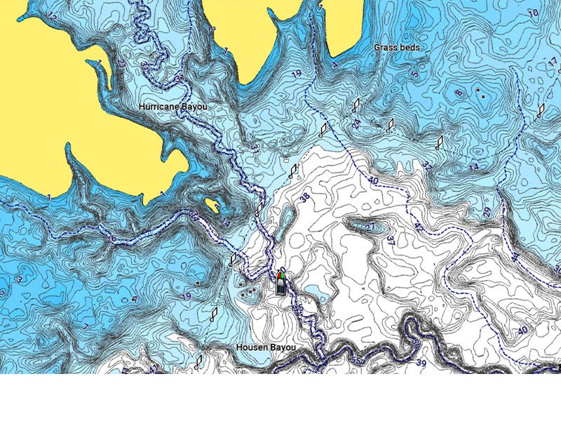
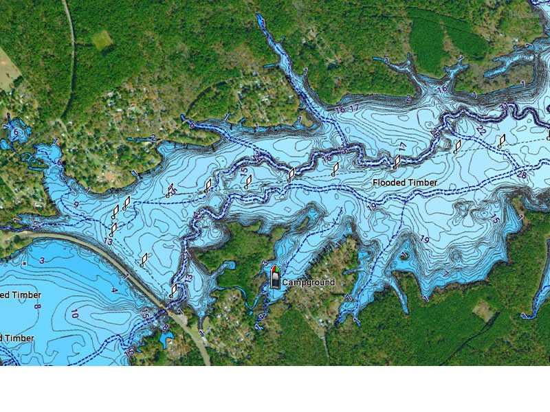
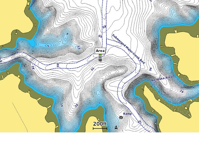
For improved fishing and navigation, up to 0.5 metre contours provide a clear depiction of bottom structure for improved fishing charts and enhanced detail in swamps, canals, harbours, marinas and more.
To give a clear picture of shallow waters to avoid, this feature allows for shading at a user-defined depth.
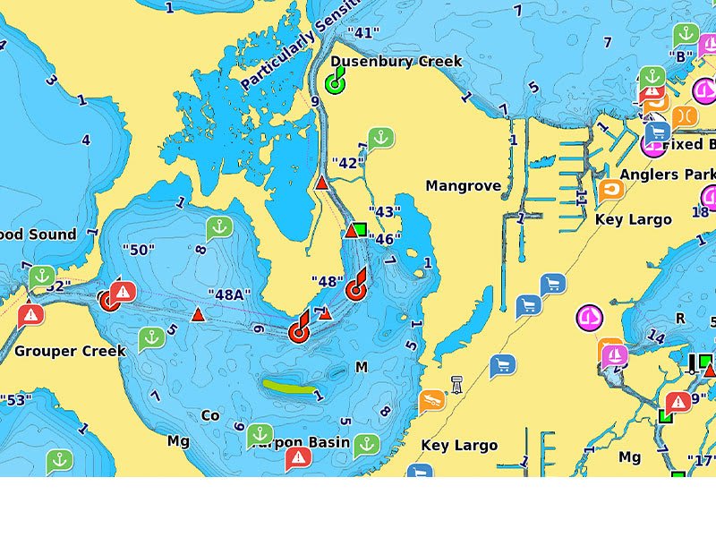
Community-sourced content provides useful points of interest, such as marinas, anchorages, hazards, businesses and more. Get recommendations from boaters with firsthand experience of the local environment.
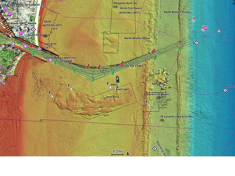
This detailed shading feature3 combines colour and shadow to give you an easy-to-interpret, clearer view of bottom structure than contour lines alone.
Downloadable high-resolution satellite imagery3 provides superior situational awareness
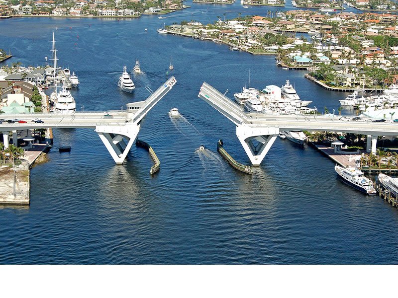
Crystal-clear aerial and surface photos of ports, marinas, bridges, docks, boat ramps, dams and navigational landmarks provide a better sense of your surroundings above the waterline.
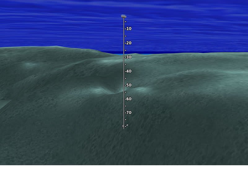
This underwater perspective shows 3D representation of bottom and contours as seen from below the waterline. Interface with sonar data for a customised view.
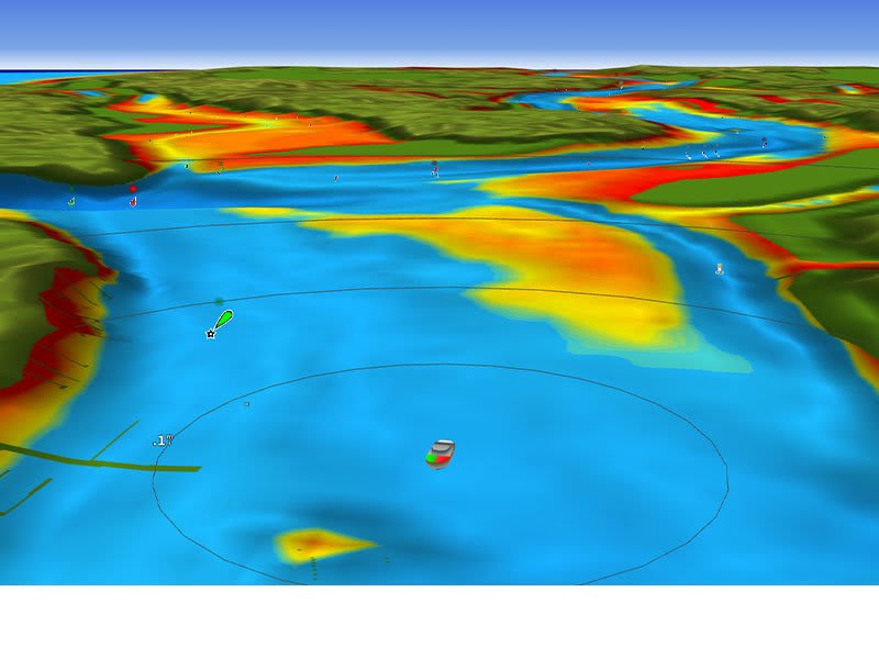
This view provides a 3D representation of the surrounding area both above and below the waterline.
Adjust your maps to the lake’s current water levels to see if spots are accessible or too shallow to explore.
| Series | |
|---|---|
| Version | Garmin Navionics Vision+ |
| Format | MICROSD™/SD™ |
General |
|
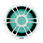
| Physical dimensions (Diameter x Depth) | 8.8″ classic speaker: 9.75″ x 5.19″ (247 x 131.5 mm) 8.8″ sports speaker: 8.82″ x 5.24″ (224 x 133 mm) 7.7″ classic speaker: 8.66″ x 4.31″ (220 x 109.5 mm) 7.7″ sports speaker: 7.72″ x 4.31″ (196 x 111 mm) 6.5″ classic speaker: 7.87″ x 4.06″ (200 x 103 mm) 6.5″ sports speaker: 6.93″ x 4.11″ (176 x 104.5 mm) |
|---|---|
| Water and dust rating | IP65 |
| Configuration | Coaxial |
| Speaker size | SG-FL882SPW / SG-FL882SPC / SG-F882W: 8.8″ SG-FL772SPW / SG-FL772SPC / SG-F772W: 7.7″ SG-FL652SPW / SG-FL652SPC / SG-F652W: 6.5″ |
| Peak power (Watts) | 8.8″ speaker: 330 W 7.7″ speaker: 280 W 6.5″ speaker: 230 W |
| RMS power (Watts) | 8.8″ speaker: 130 W 7.7″ speaker: 100 W 6.5″ speaker: 75 W |
| Sensitivity (1 W/1 m) | 8.8″ speaker: 91 dB 7.7″ speaker: 91 dB 6.5″ speaker: 90 dB |
| Frequency response | 8.8″ speaker: 50 Hz – 20 kHz 7.7″ speaker: 60 Hz – 22 kHz 6.5″ speaker: 70 Hz – 22 kHz |
| Nominal impedance | 4 ohms |
| Recommended amplifier power (RMS) | 8.8″ speaker: 25 140 W/Ch 7.7″ speaker: 25-120 W/Ch 6.5″ speaker: 30-90 W/Ch |
| LED lighting | Yes – CRGBW (sports-style only) |
| LED supply voltage | 10.8-16 VDC (sports-style only) |
| LED load current @ 14.4 VDC | 300 mA (sports-style only) |
| Operating temperature range | 32° to 122° F (0° to 50° C) |
| Voice coil diameter | 8.8″ speaker: 1.5″ 7.7″ speaker: 1.4″ 6.5″ speaker: 1.2″ |
| Cone material | CURV cone with rubber surround |
| Tweeter type | Silk dome |
| Compass-safe distance | 8.8″ speaker: 162″ (412 cm) 7.7″ speaker: 141″ (358 cm) 6.5″ speaker: 122″ (310 cm) |
| Warranty | 3 years |
One pair of speakers (based on what you select)
Documentation
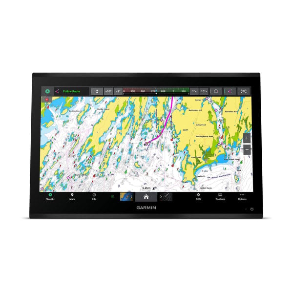
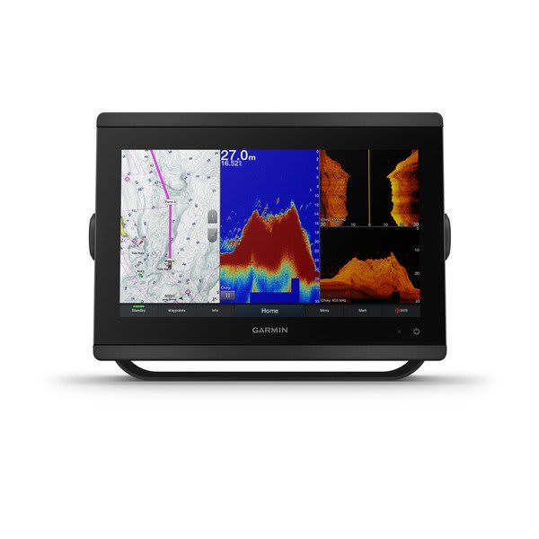
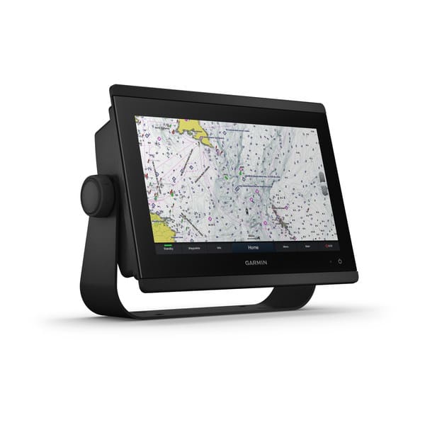
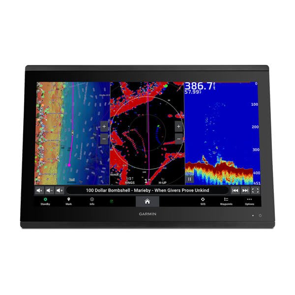
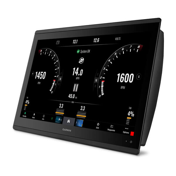
Premium chartplotter with worldwide basemap
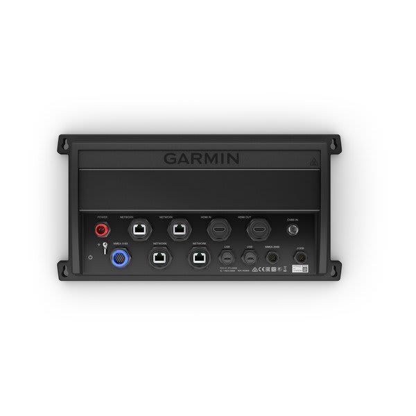
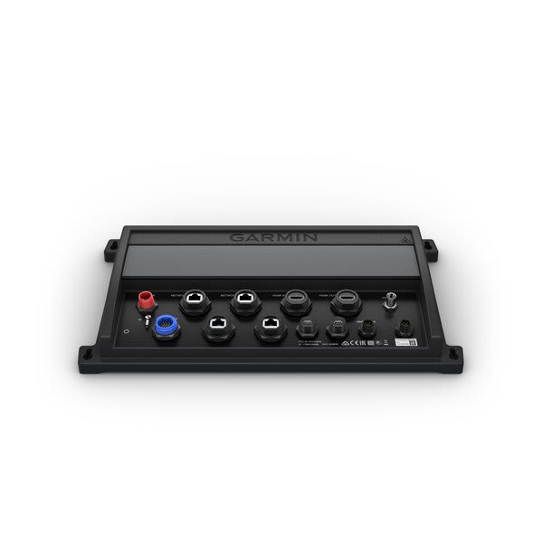
Fully integrated black box system Compatible with a single Garmin monitor or third-party touchscreen monitor Full support...
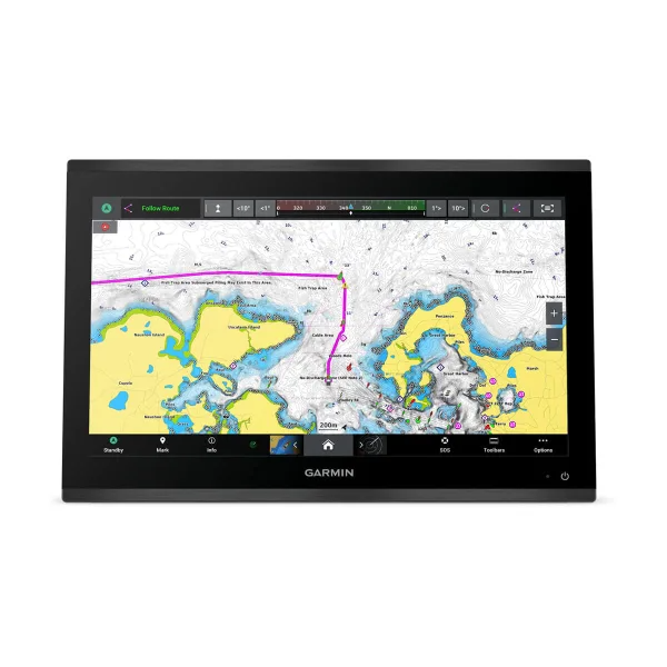
Premium chartplotter with worldwide basemap
Premium chartplotter with worldwide basemap
Fully integrated black box system Compatible with a single Garmin monitor or third-party touchscreen monitor Full support...
Premium chartplotter with worldwide basemap
Premium chartplotter with worldwide basemap