Description
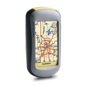
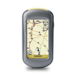
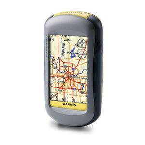
Get in touch with the great outdoors with Oregon 200. This next-generation handheld features a rugged, touchscreen along with a built-in basemap, a high-sensitivity receiver, microSD™ card slot, picture viewer and more.
Touch and Go
Oregon 200 leads the way with a tough, 3-inch diagonal, sunlight-readable, color, touchscreen display. Its easy-to-use interface means you’ll spend more time enjoying the outdoors and less time searching for information. Both durable and waterproof, Oregon 200 is built to withstand the elements. Bumps, dust, dirt, humidity and water are no match for this rugged navigator.
Find Fun
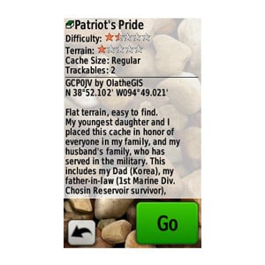
Oregon 200 supports Geocaching.com GPX files for downloading geocaches and details straight to your unit. No more manually entering coordinates and paper print outs! Simply upload the GPX file to your unit and start hunting for caches. Show off photos of your excursions with Oregon’s picture viewer. Slim and lightweight, Oregon is the perfect companion for all your outdoor pursuits.
Keep Your Fix
With its high-sensitivity, WAAS-enabled GPS receiver and HotFix™ satellite prediction, Oregon 200 locates your position quickly and precisely and maintains its GPS location even in heavy cover and deep canyons. The advantage is clear — whether you’re in deep woods or just near tall buildings and trees, you can count on Oregon to help you find your way when you need it the most.
Add Maps
Conveniently plug in optional preloaded microSD cards for all your outdoor activities on land or water (see maps tab for compatible maps). Just insert a MapSource® card with detailed street maps, and Oregon provides turn-by-turn directions to your destination. Add select topographic maps to take advantage of Oregon’s 3-D map view which gives you a better perspective of your elevation. With BlueChart® g2, you’ll get everything you need for a great day on the water including depth contours, navaids and harbors. The card slot is located inside the waterproof battery compartment, so you don’t have to worry about getting it wet.
Oregon 200
Lanyard
USB cable
Owner’s manual on disk
Quick start guide
Oregon 200
Lanyard
USB cable
Owner’s manual on disk
Quick start guide