Get advanced outdoor features, inReach satellite technology for two-way messaging and interactive SOS alerts1 plus a built-in camera — all housed in a rugged 5-inch format that’s ideal for navigation on foot, bike, kayak, ATV and more.

LARGE 5-INCH GLOVE-FRIENDLY TOUCHSCREEN

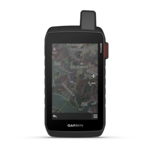
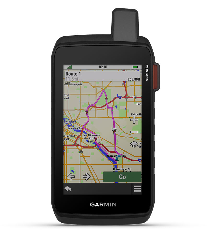
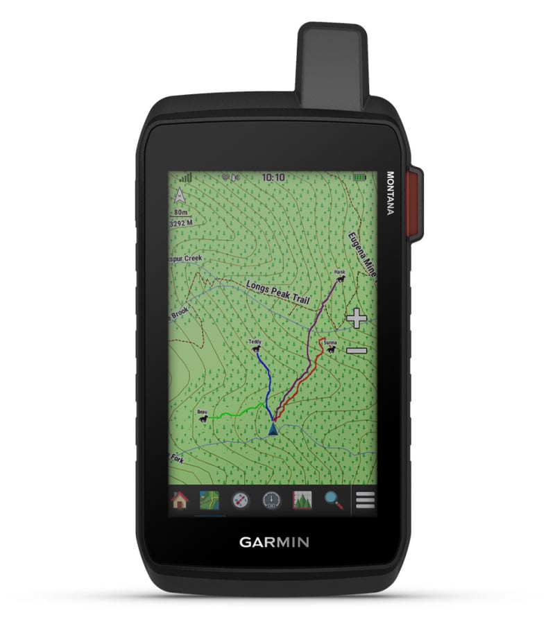
PRELOADED ROUTABLE TOPOGRAPHIC MAPS WITH LANDMARKS

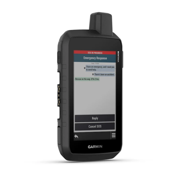
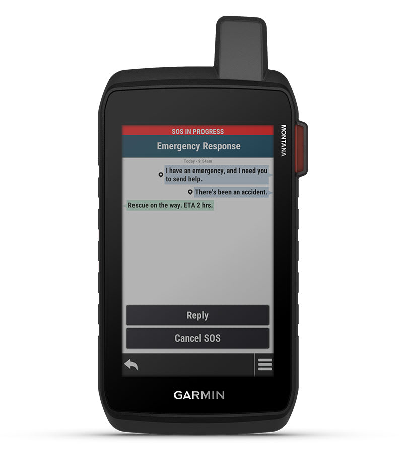
STAY IN TOUCH WITH INREACH MESSAGING AND 24/7 SOS1
USE THE BUILT-IN CAMERA TO SNAP PICS AND TAG THE LOCATION

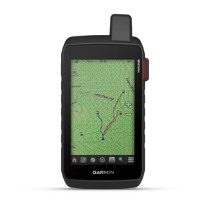
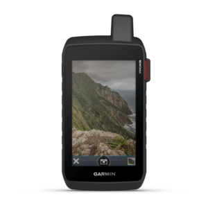
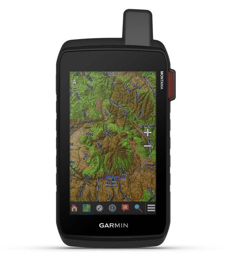
SATELLITE IMAGERY SHOWS VIVID OVERHEAD VIEWS OF YOUR ROUTE

SUPPORTS OUTDOOR MAPS+ FOR PREMIUM MAPPING (SOLD SEPARATELY)

With an active inReach subscription, you can stay connected even when your adventures go off grid. Instead of relying on smartphone coverage, now your messages, SOS and tracking are transferred via the 100% global Iridium® satellite network1
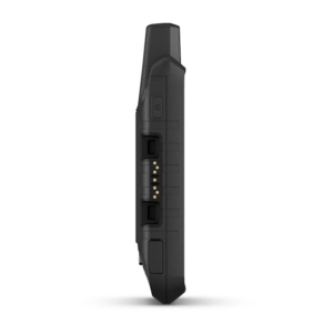
This durable, water-resistant handheld is tested to meet MIL-STD 810 for thermal, shock, water and vibration. It features a glove-friendly 5-inch touchscreen and is compatible with a variety of robust mounting solutions (sold separately) to best suit your activities.
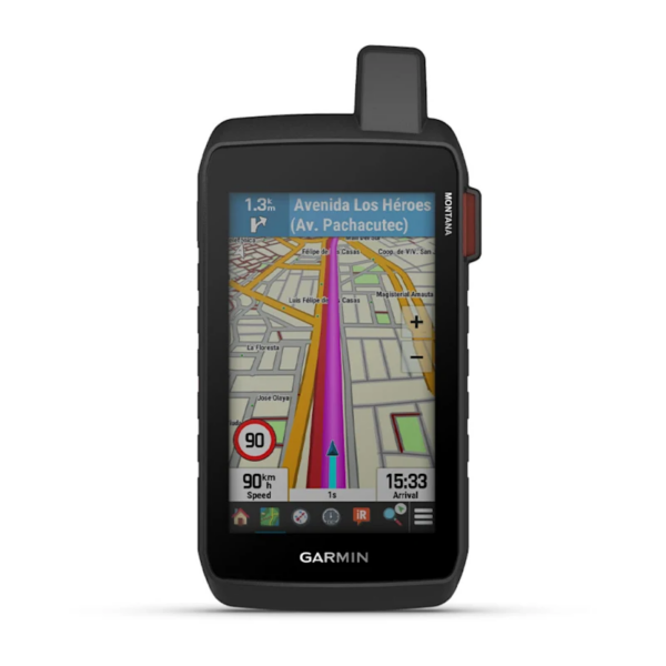
To navigate your adventures, use preloaded topographical maps. View terrain contours, elevations, coastlines, rivers, landmarks and more.
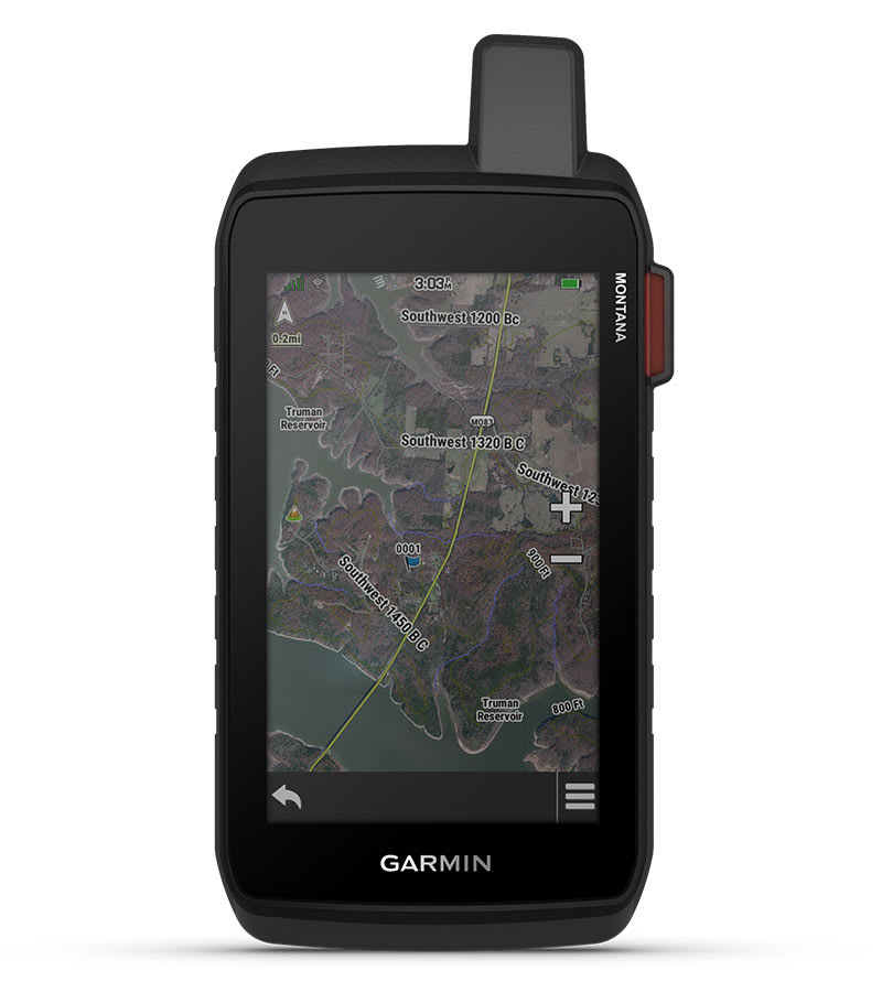
Access subscription-free, high-resolution satellite imagery with direct-to-device downloads over Wi-Fi® connectivity. See photorealistic overhead views of routes and surrounding terrain, and easily create waypoints based on landmarks.
Add a subscription to Outdoor Maps+ (sold separately), and get ongoing access to a wide variety of premium mapping content and regular updates sent right to your Garmin device via Wi-Fi technology.
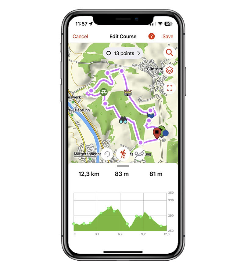
Pair with the Garmin Explore app to plan and review trip data, plus manage your waypoints, courses and activities.


Exchange text messages with loved ones back home, or communicate via inReach device to inReach device in the field1.

In case of emergency, trigger an interactive SOS message to Garmin Response℠, a 24/7-staffed professional emergency response coordination centre1.

Available inReach weather forecast service provides detailed updates directly to your Montana handheld or paired devices, so you’ll know what to expect en route1.
Using your live tracking page, followers can see your progress, ping your device to see your GPS location and exchange messages during your trip1.

Access to GPS and Galileo satellite networks enables Montana 710 to track in more challenging environments than GPS alone.

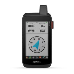
Navigate your next trail with ABC sensors, including an altimeter for elevation data, barometer to monitor weather and 3-axis electronic compass.

Access up-to-date active weather forecasts via the Garmin Connect™ app on your compatible smartphone
For hunters and trainers, this Montana handheld syncs with your compatible Astro® or Alpha® series handhelds to help track sporting dogs in the field.

This preloaded app lets you easily download hiking, cycling and other Wikiloc trails shared by outdoor enthusiasts like you. Get a free 60-day Wikiloc Premium trial to try this and other exclusive features. Learn more.

Trek far and wide off-grid. Use expedition mode, an ultralow-powered GPS reference, to keep Montana tracking for more than 2 weeks between recharges.

An internal lithium-ion battery pack provides up to 24 hours of battery life in GPS mode and recharges with a standard USB-C® cable.

A variety of Montana handheld-compatible mounts (sold separately) lets you adapt your navigator for use on ATVs, boats, cars, motorcycles, motorhomes or other vehicles.


General |
|
| Lens material | Chemically strengthened glass |
|---|---|
| Dimension | 9.19 x 18.30 x 3.27 cm (3.6″ x 7.2″ x 1.3″) |
| Weight | 410g (14.5oz) with included lithium-ion battery pack |
| Water rating | IPX7 |
| MIL-STD-810 | Yes (thermal, shock, water, vibe) |
| Touchscreen | |
| Display Type | WVGA transflective, dual orientation |
| Display Size | 6.48 x 10.80 cm (2.55″W x 4.25″H); 12.70 cm (5″ diag) |
| Display Resolution | 480 x 800 pixels |
| Battery type | Rechargeable lithium-ion (included) |
| Battery life | GPS Mode: up to 24 hours (including when a text message or location is sent every 10 minutes) Expedition Mode: up to 440 hours or up to 300 hours with a text message or location sent every 30 minutes Powered Off: up to 1 year Note – Battery life estimates are with full sky view and can be significantly impacted by obstructions or tree cover. |
| Memory/history | 32 GB (user space varies based on included mapping) |
| Interface | High speed USB-C and NMEA 0183 compatible |
Maps & memory |
|
| Preloaded maps | Yes (TopoActive Europe; City Navigator Europe – Additional regions can be downloaded over Wi-Fi®) |
|---|---|
| Ability to add maps | |
| Basemap | |
| Automatic routing (turn by turn routing on roads) for outdoor activities | |
| Automatic routing (turn by turn routing on roads) for motorized vehicles | |
| Map segments | 15 000 |
| Satellite Imagery | Yes (direct to device) |
| Includes detailed hydrographic features (coastlines, lake/river shorelines, wetlands and perennial and seasonal streams) | |
| Includes searchable points of interests (parks, campgrounds, scenic lookouts and picnic sites) | |
| Displays national, state and local parks, forests, and wilderness areas | |
| Storage and Power Capacity | Yes (32 GB max microSD™ card) |
| Waypoints/favourites/locations | 10 000 |
| Courses | 250, 200 course points per course |
| Tracks | 250 |
| Navigation Track Log | 20,000 points, 250 saved gpx tracks, 300 saved fit activities |
| Navigation Routes | 250, 250 points per route; 50 points auto routing |
| Rinex logging | |
Sensors |
|
| GPS | |
|---|---|
| Galileo | |
| Barometric altimeter | |
| Compass | Yes (tilt-compensated 3-axis) |
| High-sensitivity receiver | |
| GPS compass (while moving) | |
Daily smart features |
|
| Connect IQ™ (downloadable watch faces, data fields, widgets and apps) | |
|---|---|
| Smart notifications on handheld | |
| Weather forecasts | |
| Active Weather | |
| Compatible with Garmin Messenger app | |
| VIRB® camera remote | |
| Compatible with Garmin Connect™ Mobile | |
Safety and tracking features |
|
| LiveTrack | |
|---|---|
Tactical features |
|
| XERO™ Locations | |
|---|---|
| Ballistics solver | |
Outdoor recreation |
|
| Point-to-point navigation | |
|---|---|
| TracBack® | |
| Area calculation | |
| Fish forecast | |
| Sun and moon information | |
| Geocaching-friendly | Yes (Geocache Live) |
| Custom maps compatible | Yes (500 custom map tiles) |
| Picture viewer | |
| Camera | Yes (8 megapixel with autofocus; automatic geo-tagging) |
| LED beacon flashlight | |
inReach® features |
|
| Interactive SOS | |
|---|---|
| inReach weather | |
| Send and receive text messages to SMS and email | |
| Send and receive text messages to other inReach device | |
| Send and receive group messages | |
| Exchange locations with other inReach device | |
| MapShare compatible with tracking | |
| Virtual keyboard for custom messaging | |
| Send waypoints to MapShare during trip | |
| Send route selection to MapShare during trip | |
Outdoor applications |
|
| Compatible with Garmin Explore™ app | |
|---|---|
| Garmin Explore website compatible | |
| Smart switching between Wi-Fi, Mobile and Satellite with Garmin Messenger app | |
| Dog tracking | Yes (when paired to compatible dog track system) |
Connections |
|
| Connections Wireless Connectivity | Yes (Wi-Fi®, BLUETOOTH®, ANT+®) |
|---|---|
Functionele beschrijving Hellamarine 2LT980520517 Heklicht
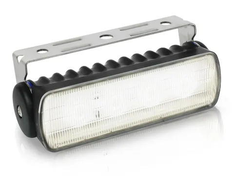
The Hella Marine 2LT 980 573-021 Sea Hawk-R LED floodlight has been designed and engineered...
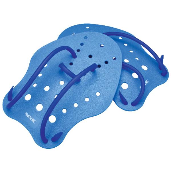
Seac Hand Paddle fins are perfect for strengthening the upper body during swimming workouts. Available...
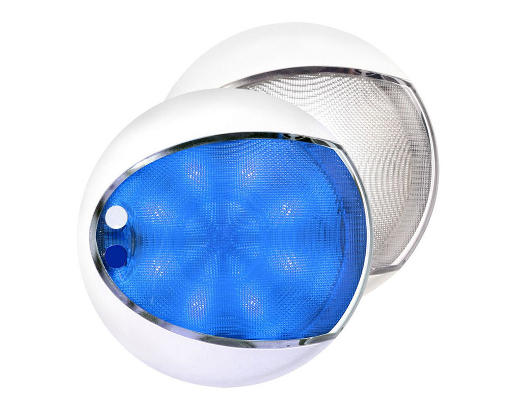

Advanced power saving dual colour LED Lights with an ultra durable design and using the...
Functionele beschrijving Hellamarine 2LT980520517 Heklicht
The Hella Marine 2LT 980 573-021 Sea Hawk-R LED floodlight has been designed and engineered...
Seac Hand Paddle fins are perfect for strengthening the upper body during swimming workouts. Available...