0 ITEMSView cart


The rugged Montana 750i handheld combines the flexibility of on- or off-road navigation with global messaging and interactive SOS via inReach satellite technology1 — plus a built-in 8-megapixel camera.
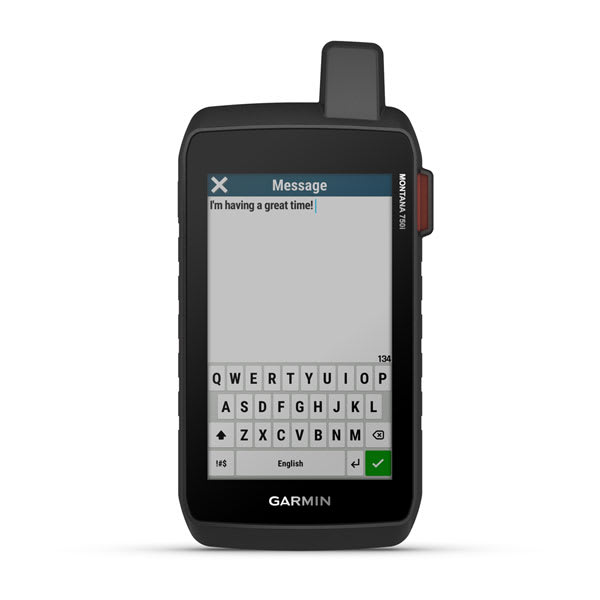
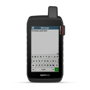
Big news. A full QWERTY keyboard lets you easily type messages.

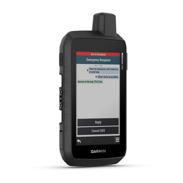
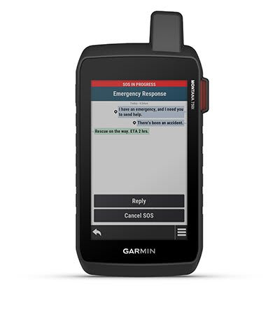
Wander wider and still stay in touch — with inReach for messaging and 24/7 SOS.

Nav, meet cam. Put your trip pics on the map with geotags.

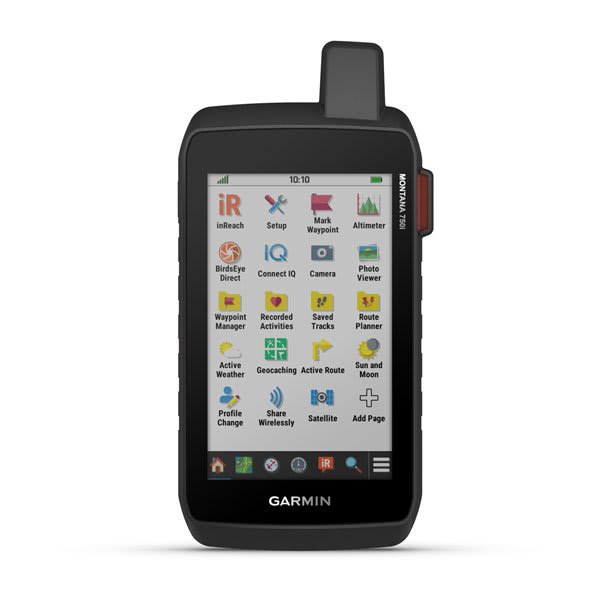
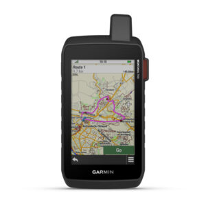
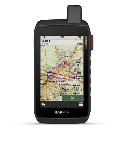
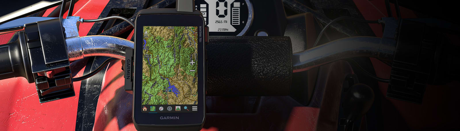
Routable TopoActive Europe maps. Now you’re free to take it off-road or on.

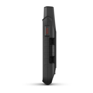
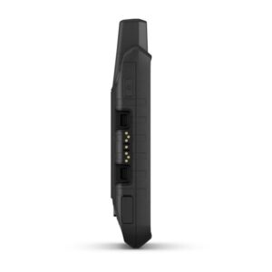
Meets MIL-STD 810 for thermal, shock, water and vibration.

Power your adventures with 18+ hours of lithium-ion battery life in GPS mode.

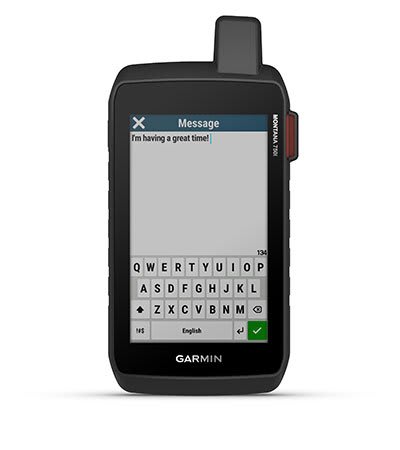
Exchange text messages with loved ones, post to social media, or communicate via inReach device to inReach device in the field (active satellite subscription required).
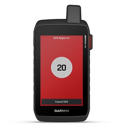
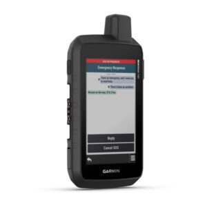
In case of emergency, trigger an interactive SOS message to GEOS, the Garmin-powered International Emergency Response Coordination Centre (IERCC) with professional 24/7 global monitoring and response centre (active satellite subscription required).
Instead of relying on cellphone coverage, now your messages, SOS and tracking are transferred via the 100% global Iridium ® satellite network (active satellite subscription required).
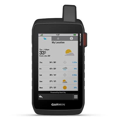
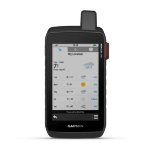
Available inReach weather forecast service provides detailed updates directly to your Montana handheld or paired devices, so you’ll know what to expect en route.

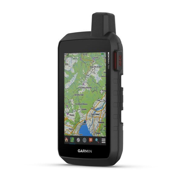
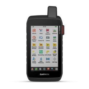
This durable, water-resistant handheld is tested to U.S. military standards and features a glove-friendly 5” touchscreen that’s 50% larger than previous Montana models.
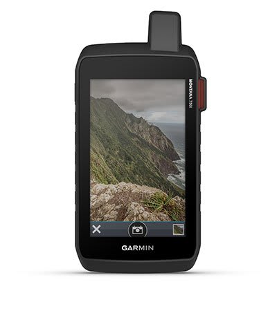
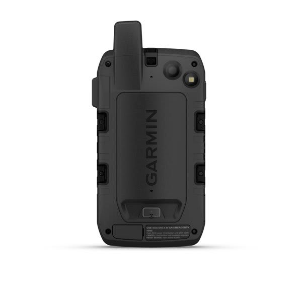
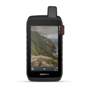
Capture images of your exploits with Montana’s digital 8-megapixel camera. It geotags photos with coordinates, so you can navigate back to favourite sites in the future.
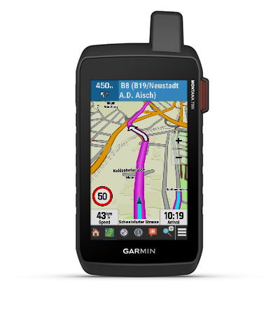
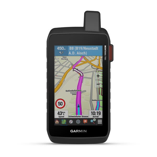
Seamlessly transition from trails to road navigation with preloaded City Navigator street mapping, which guides your drive with easy-to-follow turn-by-turn directions.
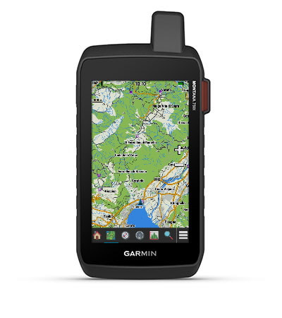
To navigate your adventures, use preloaded TopoActive Europe maps. View elevations, coastlines, rivers, landmarks and more.
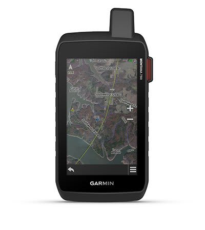
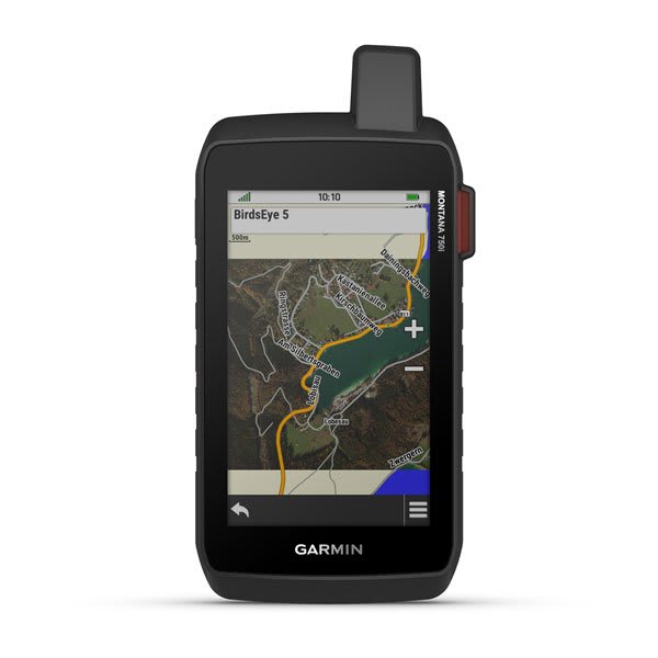
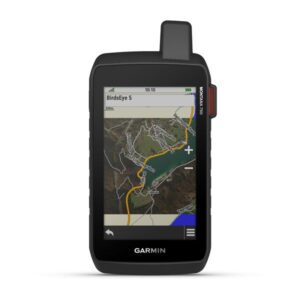
Use direct-to-device downloads of BirdsEye Satellite Imagery (no annual subscription required) to see photo-realistic views and create waypoints based on landmarks.
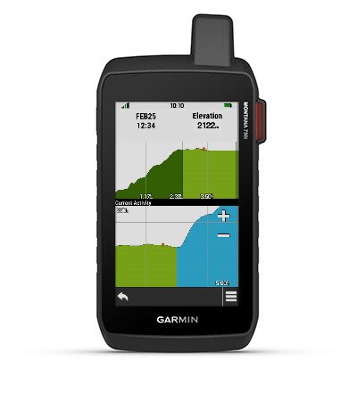
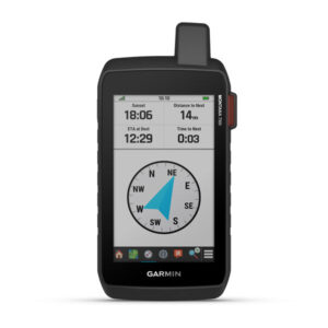
Navigate your next trail with ABC sensors, including an altimeter for elevation data, barometer to monitor weather and 3-axis electronic compass.
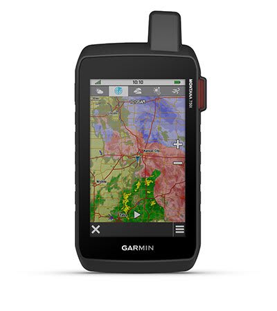
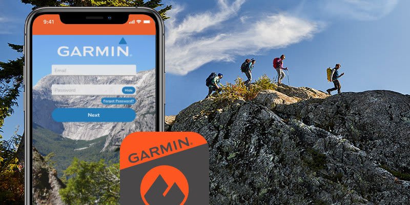
Use cellular connectivity 2 to access up-to-date Active Weather forecasts through the Garmin Connect™ app.
This Montana syncs with compatible Atemos series handhelds (sold separately) to help track dogs in the field.
Access to GPS, GLONASS and GALILEO satellite networks enables Montana ® 750i to track in more challenging environments than GPS alone.
Track your location, and share it with those at home or out in the field. They´ll be able to see your progress or ping your device for your GPS location and more via your web-based MapShare™ trip-sharing page. (Montana 700i, 750i only – satellite subscription required).
Trek far and wide off-grid. Use Expedition mode, an ultralow-power GPS reference, to keep Montana tracking for a week or more between recharges.
An internal, rechargeable lithium-ion battery pack provides more than 18 hours of battery life in GPS mode.
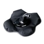
A variety of Montana handheld-compatible mounts (sold separately) lets you adapt your navigator for use on ATVs, boats, cars, motorcycles, RVs or other vehicles.

General |
|
| DIMENSION | 9.19 x 18.30 x 3.27 cm |
|---|---|
| TOUCHSCREEN | |
| DISPLAY SIZE | 6.48 x 10.80 cm; 5″ diag (12.70 cm) |
| DISPLAY RESOLUTION | 480 x 800 pixels |
| DISPLAY TYPE | WVGA transflective, dual orientation |
| WEIGHT | 410 g with included lithium-ion battery pack |
| BATTERY TYPE | rechargeable lithium-ion (included) |
| BATTERY LIFE | GPS Mode: up to 18 hoursExpedition Mode: up to 330 hoursGPS Mode, 10 min Tracking: up to 18 hoursExpedition Mode, 30 min Tracking: up to 300 hours |
| WATER RATING | IPX7 |
| MIL-STD-810 | yes (thermal, shock, water, vibe) |
| INTERFACE | High speed micro USB and NMEA 0183 compatible |
| MEMORY/HISTORY | 16 GB (user space varies based on included mapping) |
Maps & memory |
|
| PRELOADED MAPS | Yes (TopoActive Europe) |
|---|---|
| ABILITY TO ADD MAPS | |
| BASEMAP | |
| AUTOMATIC ROUTING (TURN BY TURN ROUTING ON ROADS) FOR OUTDOOR ACTIVITIES | |
| AUTOMATIC ROUTING (TURN BY TURN ROUTING ON ROADS) FOR MOTORIZED VEHICLES | |
| MAP SEGMENTS | 15000 |
| BIRDSEYE | Yes (direct to device) |
| INCLUDES DETAILED HYDROGRAPHIC FEATURES (COASTLINES, LAKE/RIVER SHORELINES, WETLANDS AND PERENNIAL AND SEASONAL STREAMS) | |
| INCLUDES SEARCHABLE POINTS OF INTERESTS (PARKS, CAMPGROUNDS, SCENIC LOOKOUTS AND PICNIC SITES) | |
| DISPLAYS NATIONAL, STATE AND LOCAL PARKS, FORESTS, AND WILDERNESS AREAS | |
| STORAGE AND POWER CAPACITY | Yes (32 GB max microSD™ card) |
| WAYPOINTS/FAVOURITES/LOCATIONS | 10000 |
| TRACKS | 250 |
| NAVIGATION TRACK LOG | 20000 points, 250 saved gpx tracks, 300 saved fit activities |
| NAVIGATION ROUTES | 250, 250 points per route; 50 points auto routing |
| RINEX LOGGING | |
Sensors |
|
| HIGH-SENSITIVITY RECEIVER | |
|---|---|
| GPS | |
| GALILEO | |
| BAROMETRIC ALTIMETER | |
| COMPASS | Yes (tilt-compensated 3-axis) |
| GPS COMPASS (WHILE MOVING) | |
Daily smart features |
|
| CONNECT IQ™ (DOWNLOADABLE WATCH FACES, DATA FIELDS, WIDGETS AND APPS) | |
|---|---|
| SMART NOTIFICATIONS ON HANDHELD | |
| WEATHER | |
| VIRB® CAMERA REMOTE | |
| COMPATIBLE WITH GARMIN CONNECT™ MOBILE | |
| ACTIVE WEATHER | |
Safety and tracking features |
|
| LIVETRACK | |
|---|---|
Outdoor recreation |
|
| POINT-TO-POINT NAVIGATION | |
|---|---|
| AREA CALCULATION | |
| HUNT/FISH CALENDAR | |
| SUN AND MOON INFORMATION | |
| XERO™ LOCATIONS | |
| GEOCACHING-FRIENDLY | yes (Geocache Live) |
| CUSTOM MAPS COMPATIBLE | yes (500 custom map tiles) |
| PICTURE VIEWER | |
| CAMERA | Yes (8 megapixel with autofocus; automatic geo-tagging) |
| LED BEACON FLASHLIGHT | |
inReach® features |
|
| INTERACTIVE SOS | |
|---|---|
| SEND AND RECEIVE TEXT MESSAGES TO SMS AND EMAIL | |
| SEND AND RECEIVE TEXT MESSAGES TO OTHER INREACH DEVICE | |
| EXCHANGE LOCATIONS WITH OTHER INREACH DEVICE | |
| MAPSHARE COMPATIBLE WITH TRACKING | |
| VIRTUAL KEYBOARD FOR CUSTOM MESSAGING | |
| SEND WAYPOINTS TO MAPSHARE DURING TRIP | |
| SEND ROUTE SELECTION TO MAPSHARE DURING TRIP | |
| INREACH REMOTE COMPATIBLE | |
Outdoor applications |
|
| COMPATIBLE WITH GARMIN EXPLORE™ APP | |
|---|---|
| GARMIN EXPLORE WEBSITE COMPATIBLE | |
| DOG TRACKING | Yes (when paired to compatible dog track system) |
Connections |
|
| CONNECTIONS WIRELESS CONNECTIVITY | Yes (Wi-Fi®, Bluetooth®, ANT+®) |
|---|---|
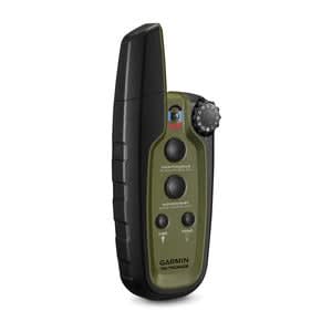
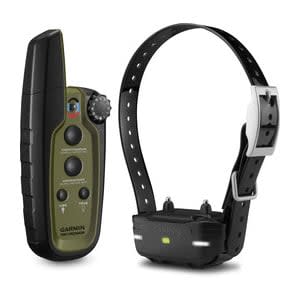
Compact, 1-handed Training of Up to 3 Dogs Compact, lightweight, ergonomically designed Simple, intuitive, “no look” 1-handed...


Compact, 1-handed Training of Up to 3 Dogs Compact, lightweight, ergonomically designed Simple, intuitive, “no look” 1-handed...
Compact, 1-handed Training of Up to 3 Dogs Compact, lightweight, ergonomically designed Simple, intuitive, “no look” 1-handed...