0 ITEMSView cart


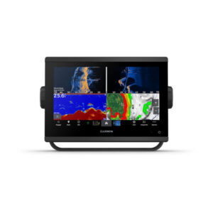
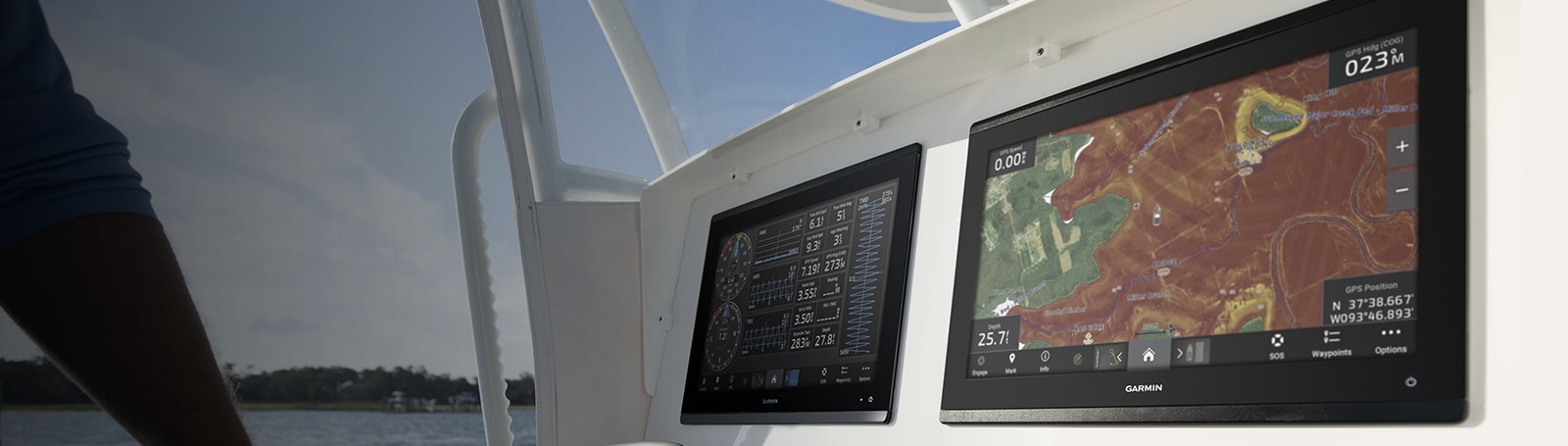
With its sleek design, powerful processing and upgraded IPS display, this advanced 7″, 9″ or 12″ chartplotter integrates seamlessly into your Garmin marine system.

Easily integrate with more engines.

Connect to compatible third-party devices with OneHelm™ digital switching.

Easily build your marine system using the best of network connectivity.

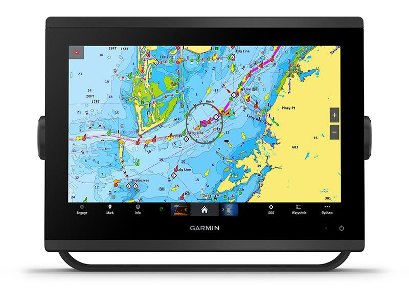
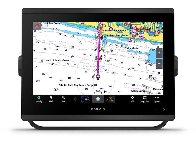
Navigate any waters with preloaded mapping and coastal chart.

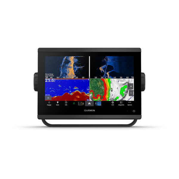
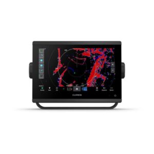
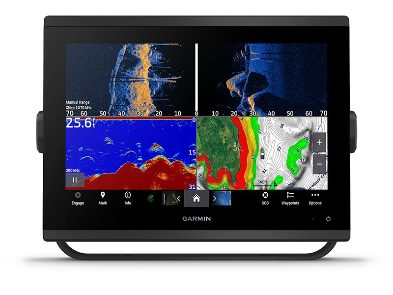
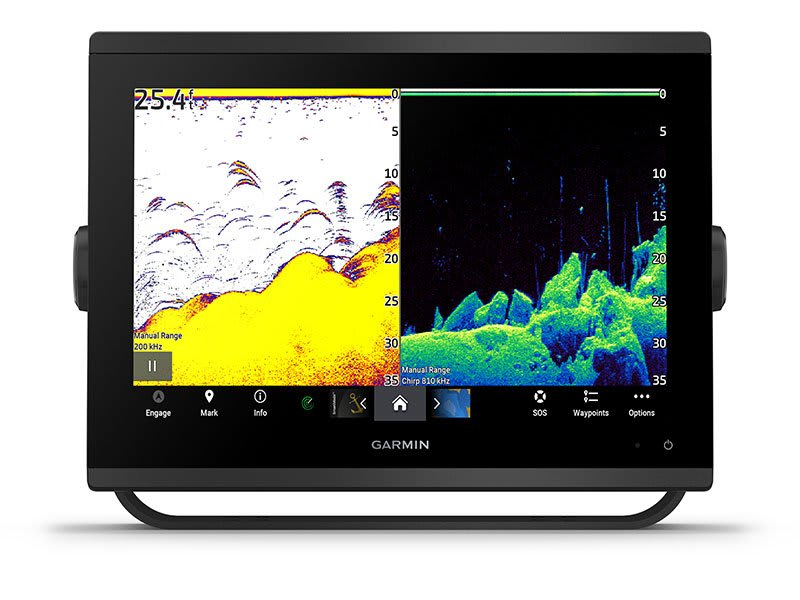
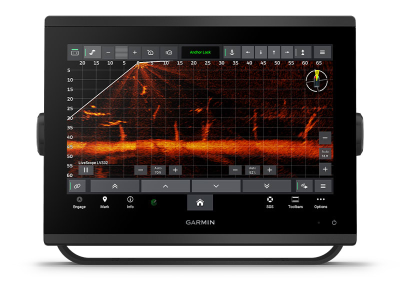
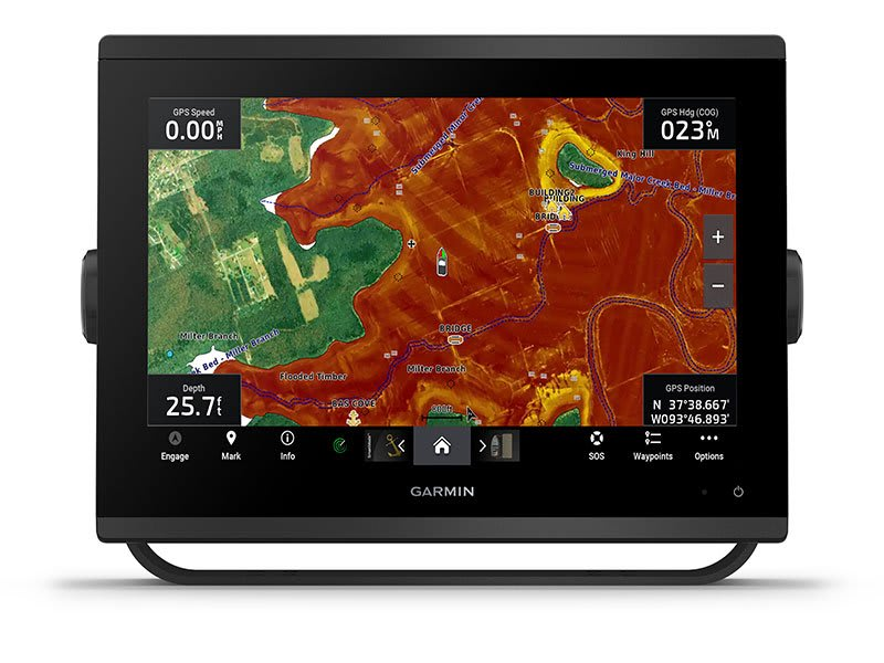
See below your boat with built-in sonar capabilities

Manage your marine experience from nearly anywhere1.
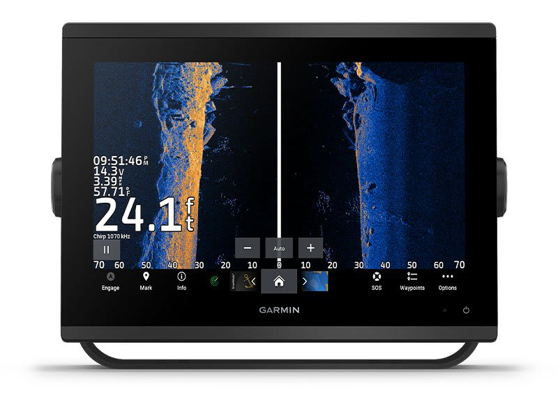
Get built-in Ultra High-Definition SideVü and ClearVü scanning sonars with vivid, high-contrast color palettes to help distinguish fish from structure. GPSMAP® X3 series also supports 1 kW CHIRP traditional sonar capabilities.
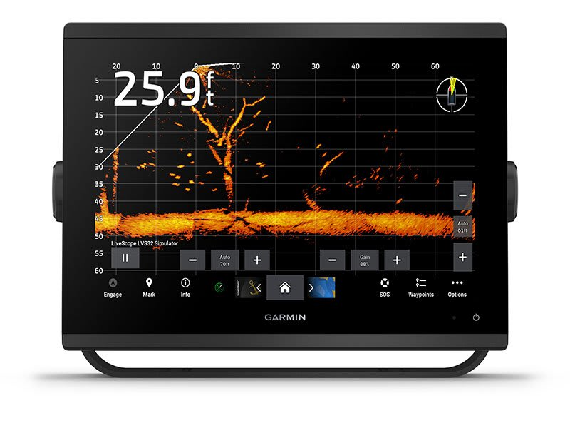
Pair with Panoptix or LiveScope™ easy-to-interpret live sonar (transducer required, sold separately) to see all around your boat in real time.
With its added processing power and new slimline design featuring edge-to-edge glass and a smaller unit footprint, it’s easy to retrofit this plotter in a wider range of dash configurations.
New higher-resolution IPS displays for 9″ and 12″ plotters offer improved sunlight readability and visibility from any angle, with 50% more pixels than previous-generation 9″ GPSMAP devices.
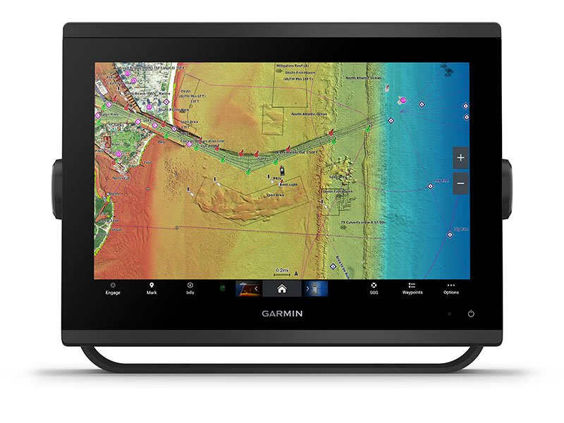
Bring a fresh new look and feel to your chartplotter with optional Garmin Navionics+™ or premium Garmin Navionics Vision+™ cartography featuring integrated coastal/inland content, access to daily updates, Auto Guidance+™ technology2 and more.
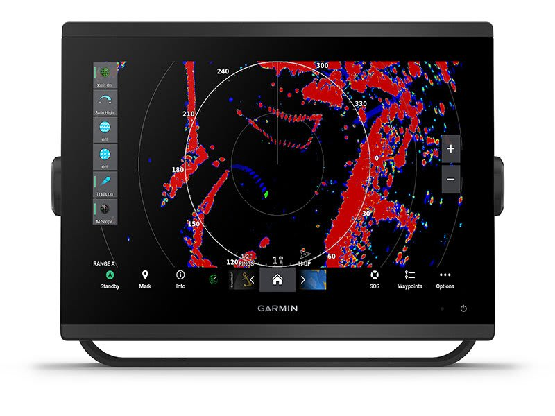
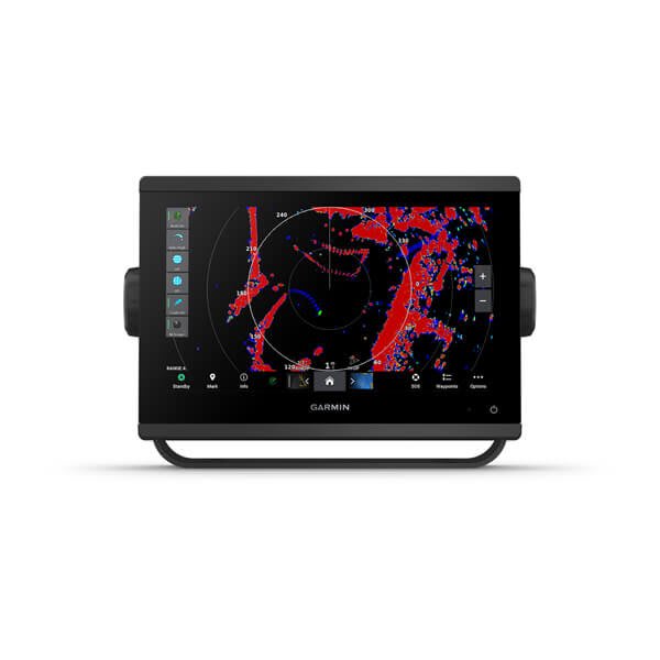
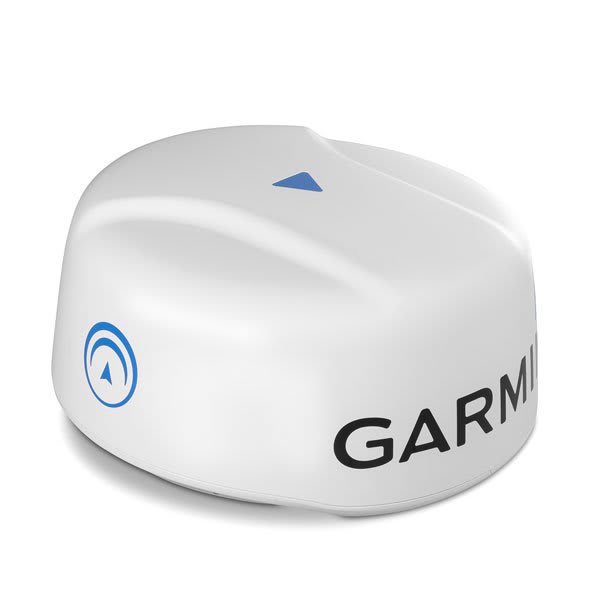
To help you avoid weather and traffic on the water, the compact 4 kW GMR™ 18 HD + dome radar is available as a bundled option with your GPSMAP chartplotter/sonar package.
By networking selected Garmin chartplotters with a Force® trolling motor and your compatible Power-Pole shallow water anchoring system, you can access advanced boat control features6 from your plotter, including smart anchor auto-deployment, smart anchor jog, auto stow, anchor drag detection and auto guidance3 end-of-route anchoring. Spend more time fishing, less time positioning.
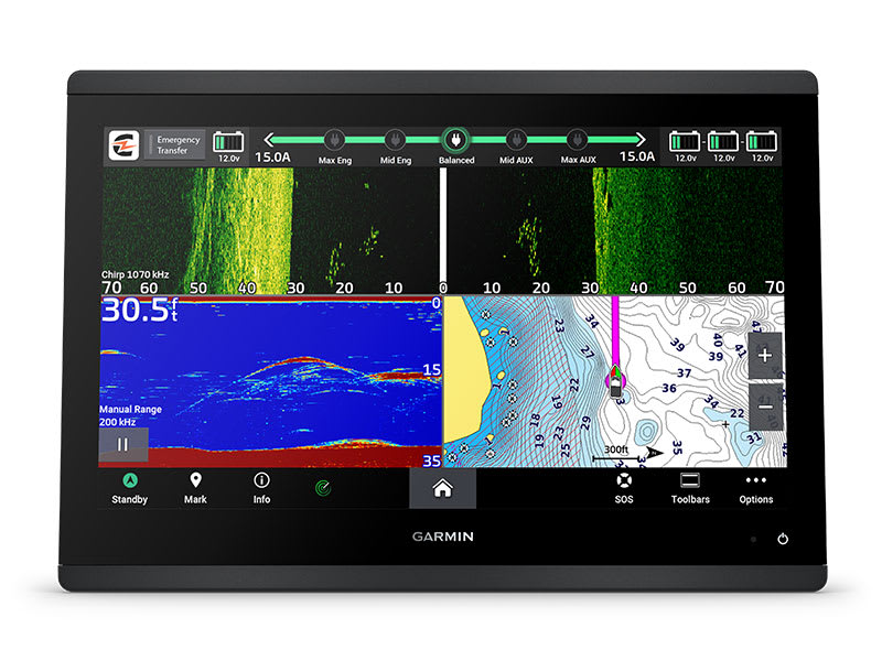
Your CHARGE Marine Power Manager from Power-Pole integrates with compatible Garmin chartplotters to help keep your battery power going longer and stronger on the water. You’re able to charge batteries on the run, monitor power use, select where power is allocated, control emergency starts and even transfer power between battery banks — all from your chartplotter display.

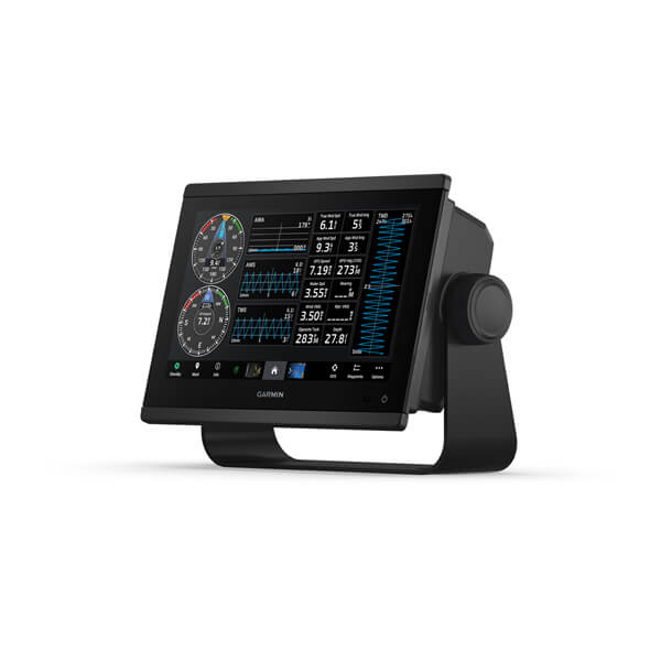
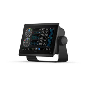
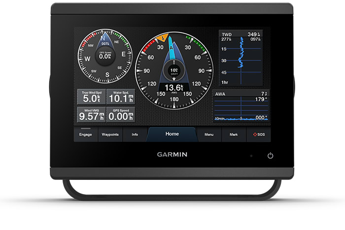
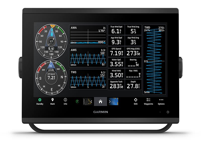
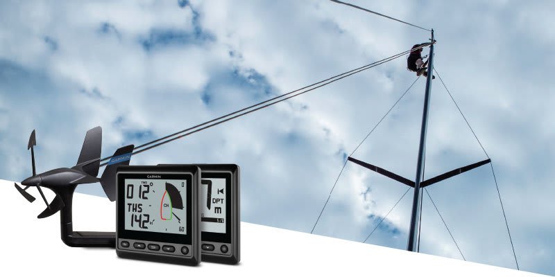
View laylines, race start line guidance, enhanced wind rose, heading and course-over-ground lines, true wind data fields and tide/current/time slider, wind angle, set and drift, wind speed and more.
These optional charts offer the best of Garmin and Navionics® data, Auto Guidance 3 technology and other premium navigation features.
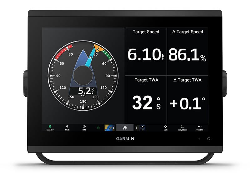
Use the polar table to see key data, including how fast you should go at a certain wind angle and speed — so you know whether you need to adjust sail trim.
Connect to autopilots, digital switching, weather, your FUSION-Link ™ audio system, media, VHF, AIS and more from one screen.
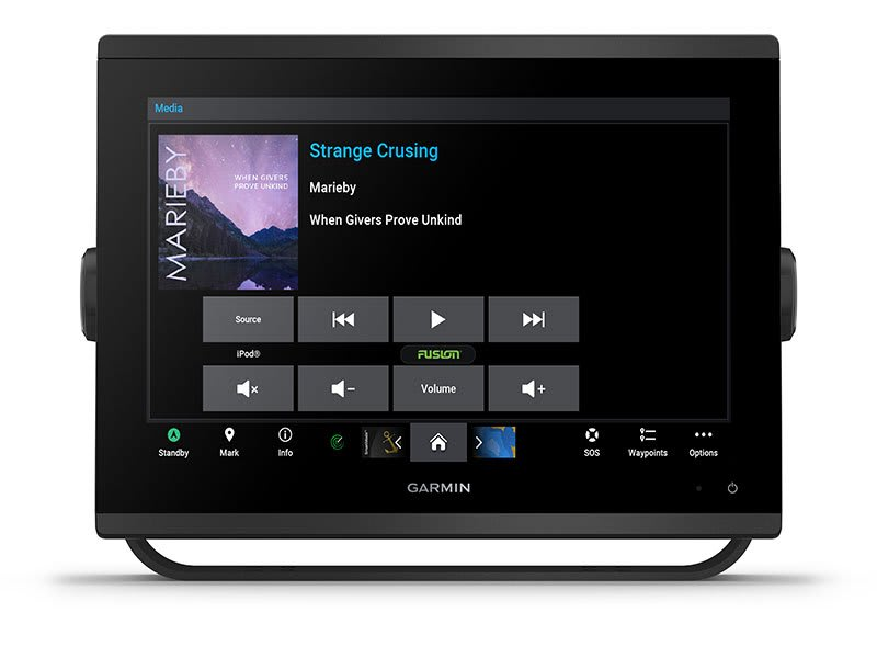
Connect to compatible autopilots, digital switching, weather, Fusion-Link™ audio system, media, VHF, AIS and more from one screen.
Built-in Wi-Fi® connectivity pairs with the free all-in-one mobile app for access to the OneChart™ feature, smart notifications 2 , software updates, Helm, Garmin Quickdraw™ Community data and more.
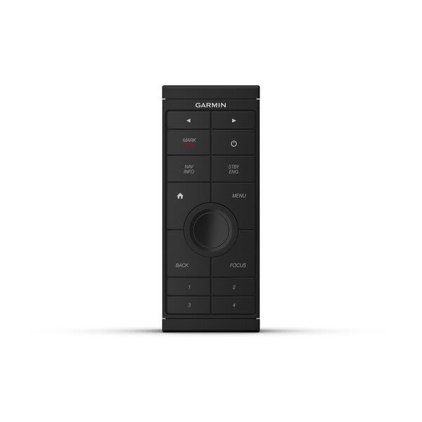
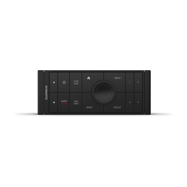
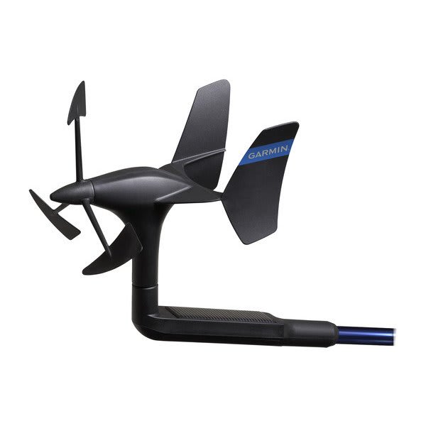
Connect with some of your favorite devices, such as quatix ® marine watches, gWind™ Wireless 2 transducers, GNX™ Wind marine instruments and wireless remote controls.
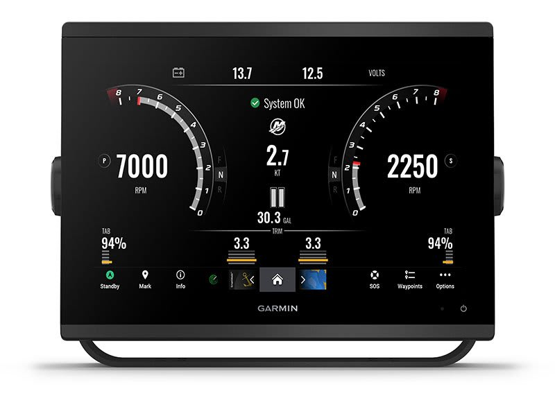
Now you can connect your chartplotter to different kinds of engines, including selected Yamaha engines.
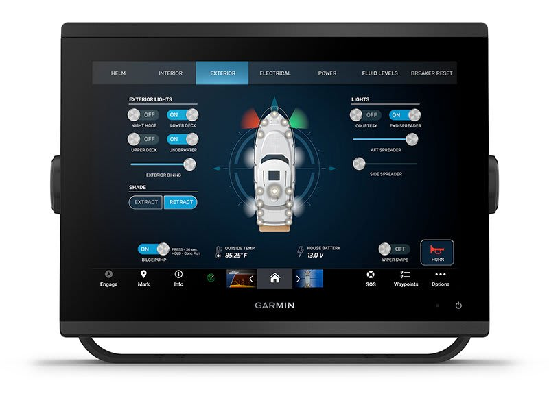
This feature brings together all the operations and capabilities of selected third-party devices, such as EmpirBus™ digital switching, on one screen.
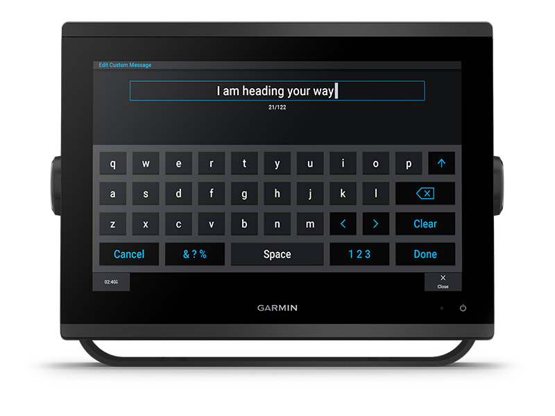
Pair your inReach satellite communicator5 to your chartplotter, and type custom messages using your MFD’s on-screen keyboard. Access your contact list or enter an email, inReach address or phone number. You can also group messages by conversation for a texting-like experience.
General |
|
| DIMENSION | 9.2″ x 6.4″ x 3″ (23.3 x 16.2 x 7.6 cm) |
|---|---|
| TOUCHSCREEN | |
| INPUT | Touchscreen |
| DISPLAY SIZE | 7.8\” x 4.4\”; 9.0\” diagonal (19.9 x 11.2 cm; 22.9 cm diagonal) |
| DISPLAY RESOLUTION | 1280 x 720 pixels |
| DISPLAY TYPE | WXGA display |
| WEIGHT | 3.6 lbs (1.6 kg) |
| WATER RATING | IPX7 |
| MOUNTING OPTIONS | Bail, flush or flat |
Maps & memory |
|
| ACCEPTS DATA CARDS | 2 microSD™ cards (back of unit) |
|---|---|
| WAYPOINTS | 5,000 |
| TRACK POINTS | 50,000 |
| TRACKS | 50 saved tracks |
| NAVIGATION ROUTES | 100 |
Sensors |
|
| HAS BUILT-IN RECEIVER | |
|---|---|
| RECEIVER | 10 Hz high-sensitivity |
| NMEA 2000® COMPATIBLE | |
| NMEA 0183 COMPATIBLE | |
| GPS | |
| GLONASS | |
| GALILEO | |
| SUPPORTS WAAS | |
Built-in Maps |
|
| BUILT-IN AUTO GUIDANCE | |
|---|---|
| BLUECHART (COASTAL) | |
| LAKEVU (INLAND) | |
| (SOUNDER) TIDE TABLES | |
Optional Map Support |
|
| BLUECHART G3 | |
|---|---|
| BLUECHART G3 VISION | |
| LAKEVÜ G3 | |
| LAKEVÜ G3 ULTRA | |
| GARMIN NAVIONICS+™ | |
| GARMIN NAVIONICS VISION+™ | |
| (SOUNDER) TOPO | |
| STANDARD MAPPING | |
| GARMIN QUICKDRAW CONTOURS | |
| RASTER CHART SUPPORT | |
Chartplotter Features |
|
| GARMIN SMARTMODE COMPATIBLE (CUSTOMISABLE MONITOR PRESETS) | |
|---|---|
| AIS | |
| DSC | |
| SUPPORTS FUSION-LINK™ COMPATIBLE RADIOS | |
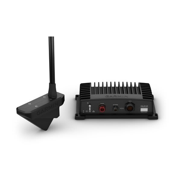
| GSD BLACK BOX SONAR SUPPORT | |
| GCV™ BLACK BOX SONAR SUPPORT | |
| ACTIVECAPTAIN MOBILE PLANNING COMPATIBLE | |
| GRID™ (GARMIN REMOTE INPUT DEVICE) COMPATIBLE | |
| WIRELESS REMOTE COMPATIBLE | |
| SAILING-FEATURES | |
| SPOKEN AUDIO ALERTS | |
| ONEHELM SUPPORT | |
Sonar Features & Specifications |
|
| DISPLAYS SONAR | |
|---|---|
| POWER OUTPUT | 1 kW |
| TRADITIONAL SONAR (DUAL FREQUENCY/BEAM) | built-in (single channel CHIRP, 70/83/200 kHz, L, M, H CHIRP) |
| CLEARVÜ | built-in 260/455/800/1000/1200 kHz |
| (SOUNDER) SIDEVÜ | built-in 260/455/800/1000/1200 kHz |
| PANOPTIX™ SONAR | |
| LIVESCOPE | |
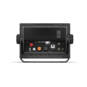
Connections |
|
| NMEA 2000 PORTS | 1 |
|---|---|
| CONNECTIONS NMEA0183 INPUT PORTS | 1 (Differential) |
| NMEA 0183 INPUT (TX) PORTS | 1 |
| VIDEO INPUT PORTS | 1 BNC |
| J1939 PORTS | 1 |
| CONNECTIONS GARMIN MARINE NETWORK PORTS | 1 |
| 12-PIN TRANSDUCER PORTS | 1 |
| USB PORTS | |
| BNC EXTERNAL GPS ANTENNA PORT | |
| BLUETOOTH® CALLING | |
| ANT+ (CONNECTIVITY) | |
| GARMIN WI-FI NETWORK (LOCAL CONNECTION) | |
Electrical Features |
|
| POWER INPUT | 10 to 32 Vdc |
|---|---|
| TYPICAL CURRENT DRAW AT 12 VDC | 1.37 A |
| MAXIMUM CURRENT DRAW AT 12 VDC | 3.20 A |
| MAXIMUM POWER USAGE AT 10 VDC | 40.2W |

MANUALS

SOFTWARE

SUPPORT CENTER


Above contents plus:
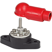
Compact, high-amp fuse?appropriate for DC Main, inverter, windlass, and bow thruster circuit protection Provides high current...
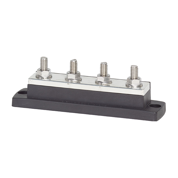
The industry standard busbar for positive distributionThe industry standard busbar for the collection of negative...
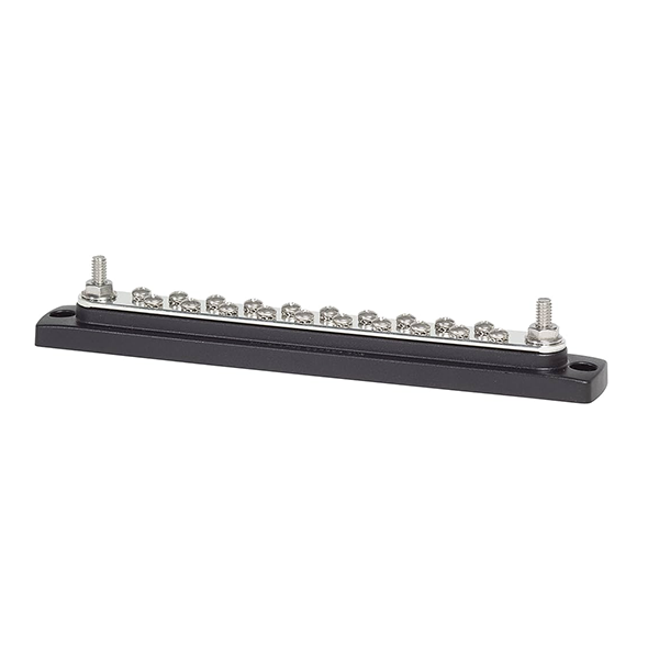
The industry standard busbar for positive distributionThe industry standard busbar for the collection of negative...
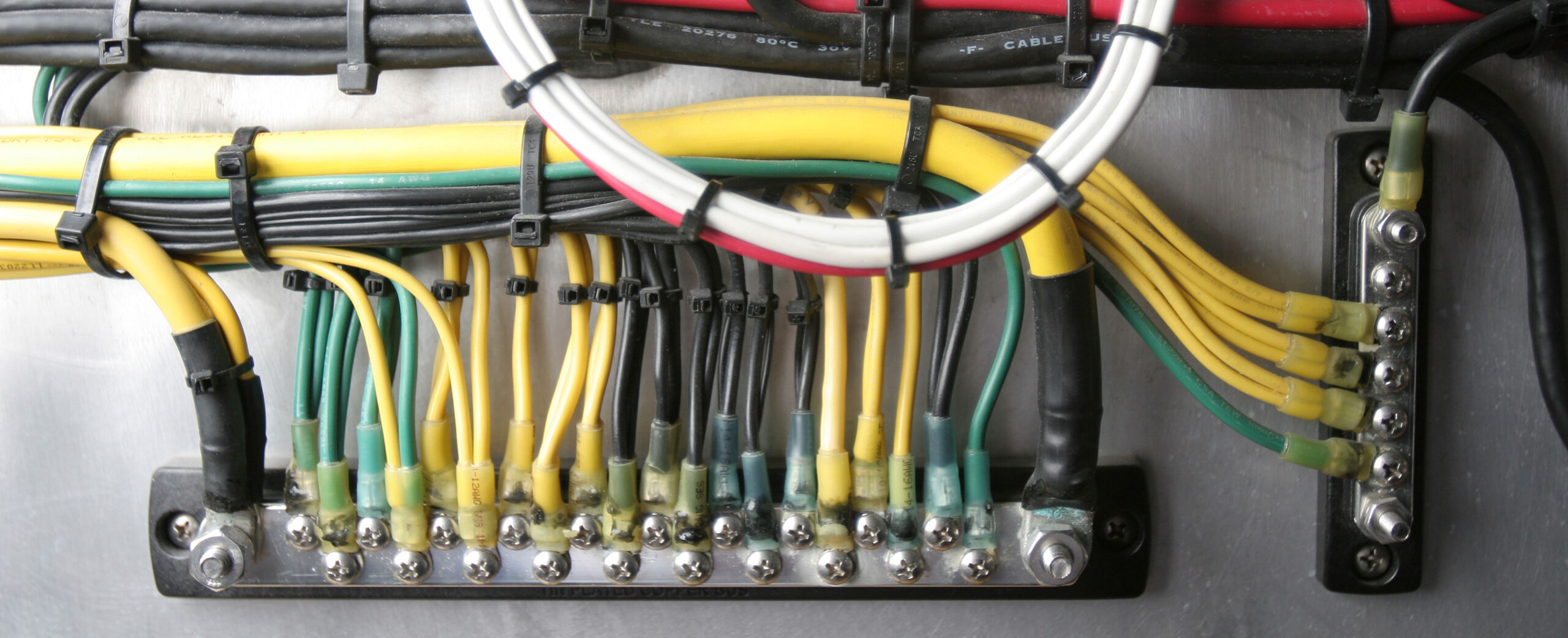
Enables connection of multiple smaller wires in spaces where a traditional bus bar may not...
Compact, high-amp fuse?appropriate for DC Main, inverter, windlass, and bow thruster circuit protection Provides high current...
The industry standard busbar for positive distributionThe industry standard busbar for the collection of negative...
The industry standard busbar for positive distributionThe industry standard busbar for the collection of negative...
Enables connection of multiple smaller wires in spaces where a traditional bus bar may not...
Compact, high-amp fuse?appropriate for DC Main, inverter, windlass, and bow thruster circuit protection Provides high current...
The industry standard busbar for positive distributionThe industry standard busbar for the collection of negative...