1 ITEMView cart
-
Garmin Gpsmap 66I 1 × AED 2,078.00

Your order qualifies for free shipping!
Subtotal: AED 2,078.00

Subtotal: AED 2,078.00
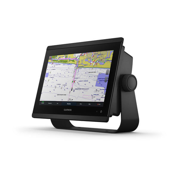
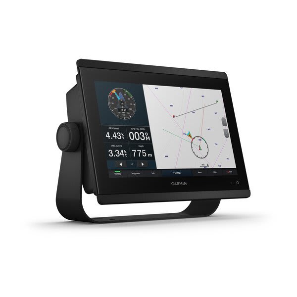
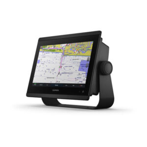
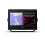
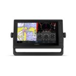
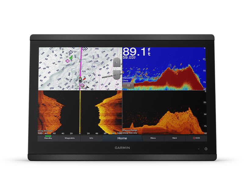
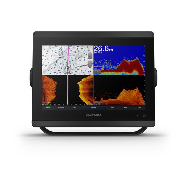
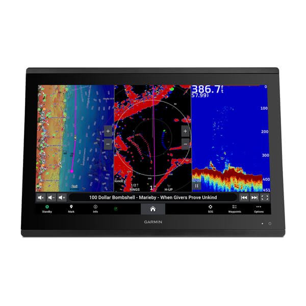
The easy-to-use, easy-to-install chartplotter/sonar combo delivers MFD performance in a combo-size package.

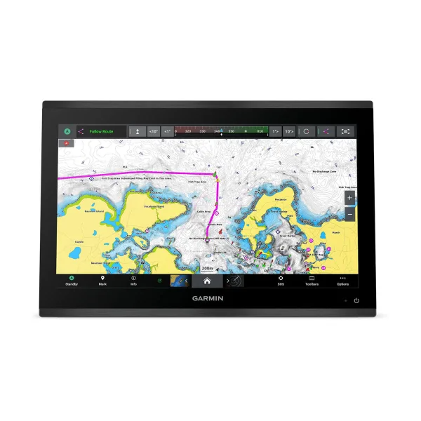
Get wider viewing angles and superior clarity on the touchscreen with a full HD in-plane switching (IPS) display.

It’s compatible with premium maps and charts for the best in Garmin navigation.

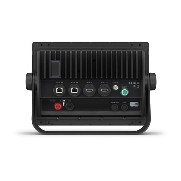
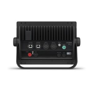
Easily build your marine system using the best of network connectivity.

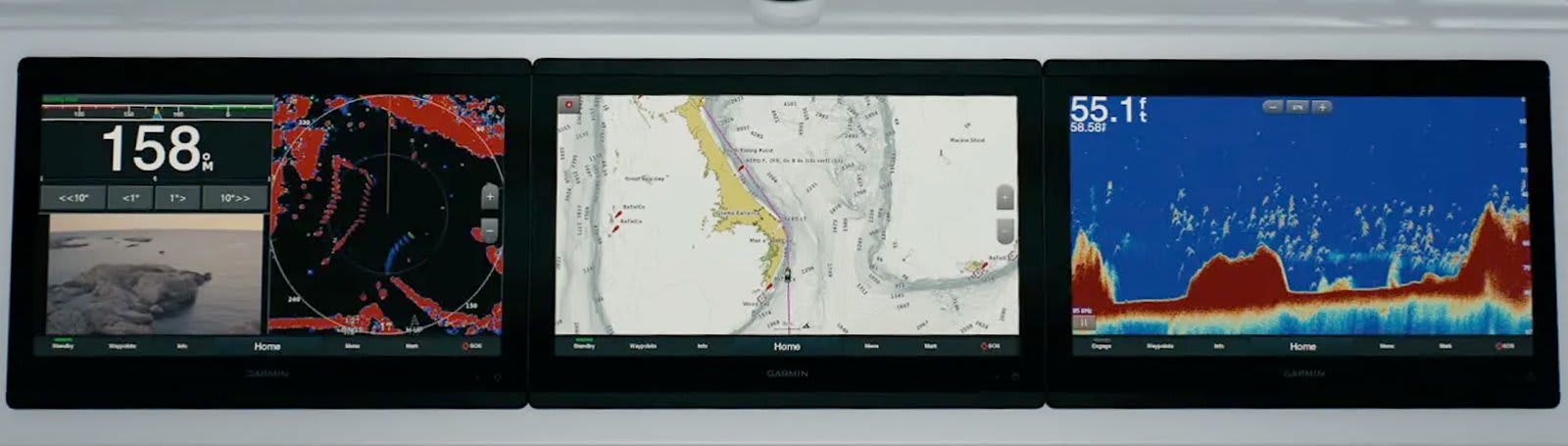
See below and around your boat with built-in sonar capabilities (transducers sold separately)

From ANT® technology to Wi-Fi® networking, there are countless ways to connect to your system.

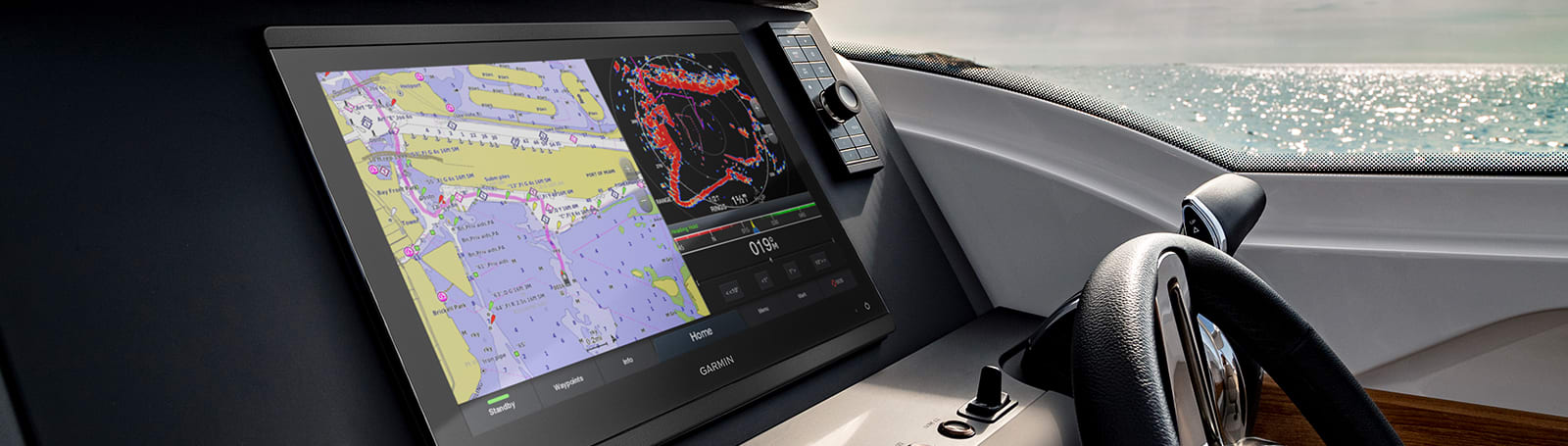
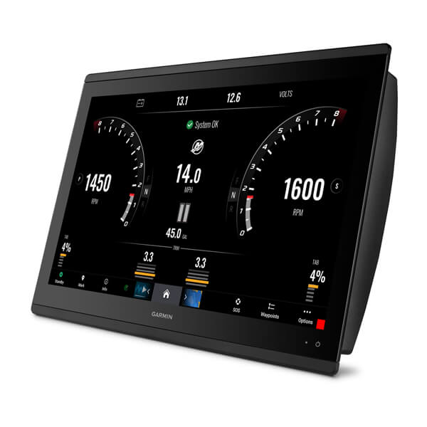
With SmartMode™ station controls, everything is designed to give you quick, one-touch access to the information you need.
Available in 10″, 12″ or 16″, this display offers wider viewing angles, superior clarity and sunlight readability, even with polarized sunglasses.
You can install multiple displays, either flat mounted edge-to-edge for a sleek glass helm look or mounted flush — creating a stunning helm.
The optional, easy-to-use GRID 20 remote input device provides intuitive remote access and control of your entire Garmin marine system.
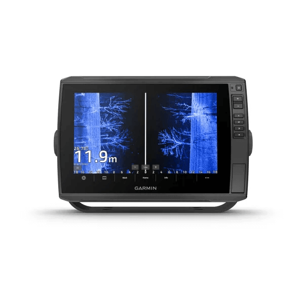
Get built-in support for 1-kW Dual-Channel CHIRP traditional sonar for superior target separation and ClearVü and SideVü scanning sonars to see up to 1,000’ below and around your boat at 260 kHz (requires transducer, sold separately).
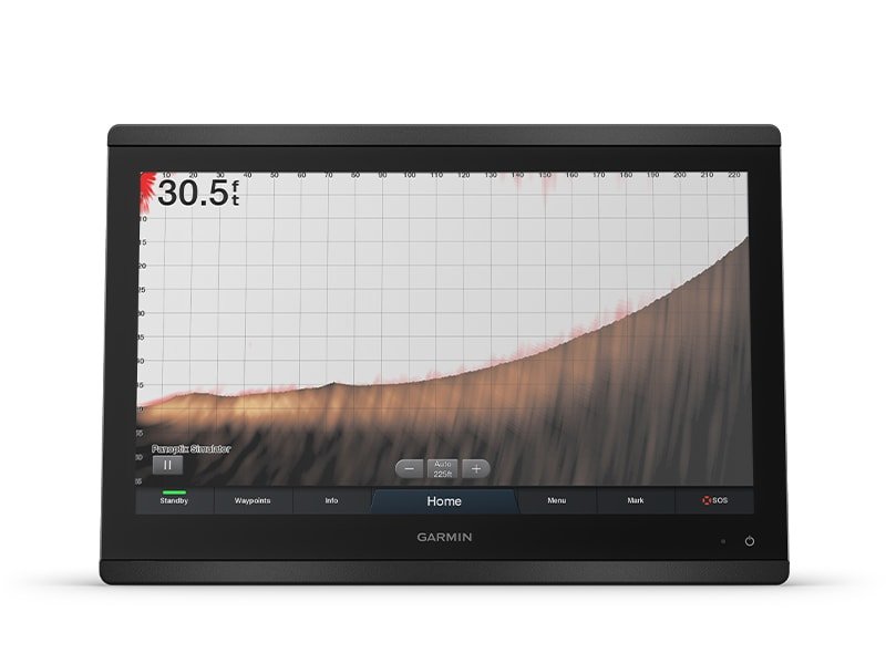
Pair your chartplotter with Panoptix or Panoptix LiveScope™ easy-to-interpret live sonar (transducer sold separately) to see all around your boat in real time.
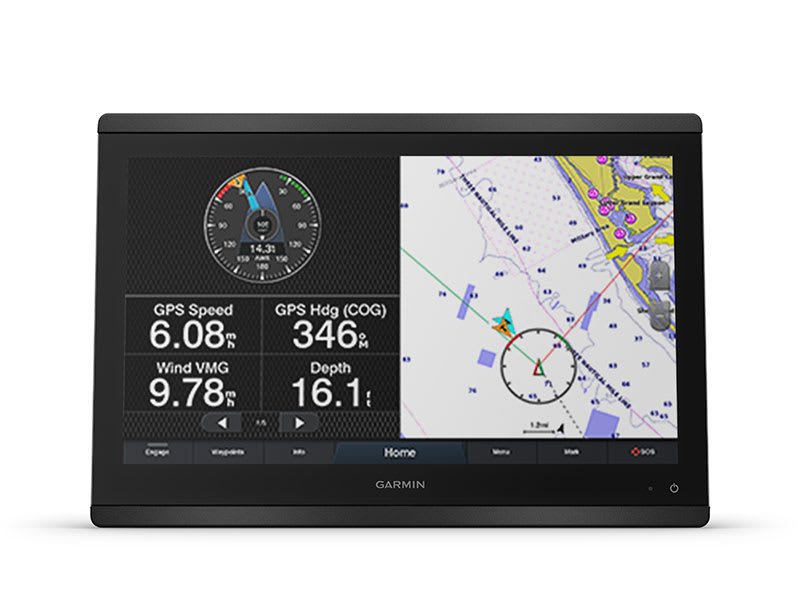
View laylines, race start line guidance, enhanced wind rose, heading and course-over-ground lines, true wind data fields and tide/current/time slider, wind angle, set and drift, wind speed and more.
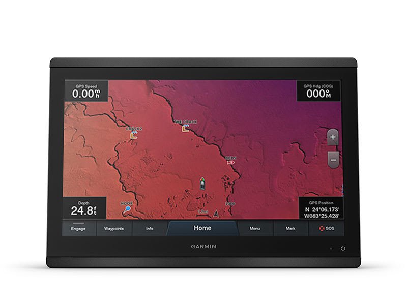
Experience unparalleled coverage and detail with optional BlueChart® g3 coastal charts featuring integrated Garmin and Navionics® content and Auto Guidance 1 technology.
| Series | |
|---|---|
| Display Size | 16" |
| Sonar Type | No |
General |
|
| Dimension | 30.3 cm x 21.6 cm x 7.6 cm |
|---|---|
| Touchscreen | |
| Display Size | 25.7 cm x 14.5 cm; 11.6″ (29.5 cm) diagonal |
| Display Resolution | FHD; 1920 x 1200 px |
| Display Type | Touchscreen IPS display (anti-glare finish) |
| Weight | 2.7 kg |
| Water rating | IPX7 |
| Mounting Options | Bail, flat or flush. (Garmin does not offer any hardware or accessories for a flat-mount installation. Professional tools and knowledge is required.) |
Maps & memory |
|
| Accepts data cards | 2 SD™ cards (on back of unit) |
|---|---|
| Waypoints | 5,000 |
| Track points | 50,000 |
| Tracks | 50 saved tracks |
| Navigation Routes | 100 (250 waypoints each) |
Sensors |
|
| Has built-in receiver | |
|---|---|
| Receiver | 10 Hz GPS/GLONASS/Galileo |
| NMEA 2000® compatible | |
| NMEA 0183 Compatible | |
| GPS | |
| GLONASS | |
| Galileo | |
| Supports WAAS | |
Built-in Maps |
|
| Built-in Auto Guidance | |
|---|---|
| BlueChart (coastal) | |
| LakeVu (inland) | |
| (Sounder) Tide tables | |
Optional Map Support |
|
| BlueChart g3 | |
|---|---|
| BlueChart g3 Vision | |
| LakeVü g3 | |
| LakeVü g3 Ultra | |
| Garmin Navionics+™ | |
| Garmin Navionics Vision+™ | |
| (Sounder) TOPO | |
| Standard Mapping | |
| Garmin Quickdraw Contours | |
| Raster chart support | |
Chartplotter Features |
|
| Garmin SmartMode compatible (customisable monitor presets) | |
|---|---|
| AIS | |
| DSC | |
| Supports Fusion-Link™ compatible radios | |
| GSD Black Box Sonar Support | |
| GCV™ Black Box sonar support | |
| ActiveCaptain Mobile Planning Compatible | |
| GRID™ (Garmin Remote Input Device) compatible | |
| Wireless remote compatible | |
| sailing-features | |
| Spoken audio alerts | |
| OneHelm support | |
Sonar Features & Specifications |
|
| Displays sonar | |
|---|---|
| Traditional sonar (dual frequency/beam) | yes (with GCV™ black box, sold separately) |
| ClearVü | yes (with GCV™ black box, sold separately) |
| (Sounder) SideVü | yes (with compatible black box sonar) |
| Panoptix™ sonar | |
| LiveScope | |
Connections |
|
| NMEA 2000 ports | 1 |
|---|---|
| Connections NMEA0183 Input Ports | 1 differential |
| NMEA 0183 input (Tx) ports | 1 |
| Video input ports | 1 – BNC composite1 – HDMI (HDCP compliant) |
| Video output ports | 1 HDMI |
| J1939 ports | 1 |
| Connections Garmin Marine Network Ports | 2 |
| USB ports | |
| BNC external GPS antenna port | |
| Bluetooth® calling | |
| ANT+ (Connectivity) | |
| Garmin Wi-Fi network (local connection) | |
Electrical Features |
|
| Power Input | 10 to 32 Vdc |
|---|---|
| Typical current draw at 12 Vdc | 1.3 A |
| Maximum current draw at 12 Vdc | 6.0 A |
| Maximum power usage at 10 Vdc | 45W |
GPSMAP® 8416
Power cable
NMEA 2000® drop cable
NMEA 2000 T-connector
Flush mount kit
Sun cover
Trim piece snap covers
Documentation

With Worldwide Basemap and Sonar
With Worldwide Basemap and Sonar

102sv with GT56UHD-TM Transducer

Castable Sonar Device – Without GPS
Premium chartplotter with worldwide basemap
With Worldwide Basemap and Sonar
With Worldwide Basemap and Sonar
102sv with GT56UHD-TM Transducer
Castable Sonar Device – Without GPS
Premium chartplotter with worldwide basemap
With Worldwide Basemap and Sonar
With Worldwide Basemap and Sonar
102sv with GT56UHD-TM Transducer