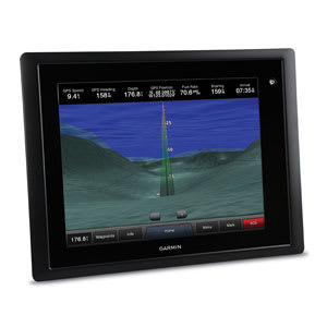
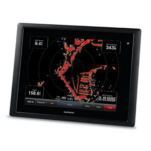
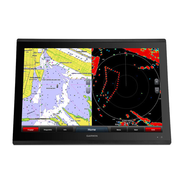
Our fully-integrated 20 cm (8″) touchscreen multifunction display (MFD) includes the best marine user interface from Garmin. The epitome of the Power of Simple™, the GPSMAP 8008 is one of the most technologically-advanced, easiest to use MFDs we have ever offered.
The bright SVGA touchscreen comes standard with a worldwide, satellite-enhanced basemap and includes pinch-to-zoom and other touch controls to give you intuitive operation. Anti-glare and LED backlighting makes this series our easiest to view in bright sunlight. Auto-dimming provides outstanding visibility at night.
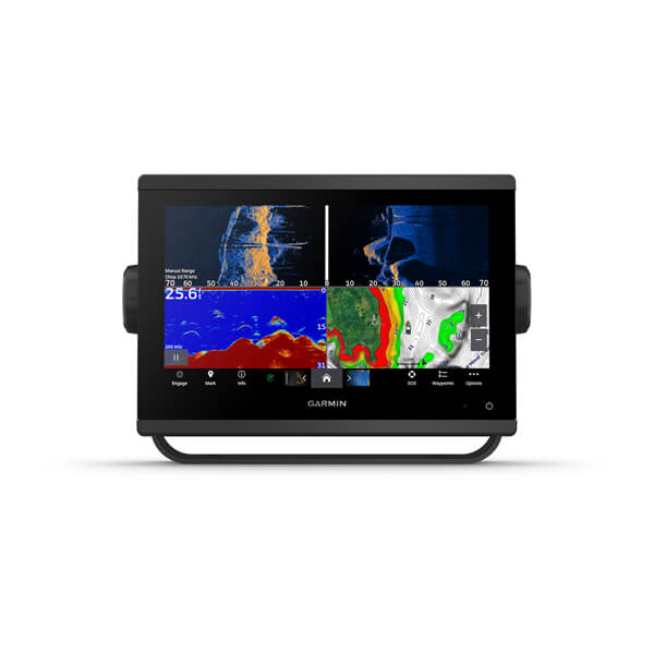
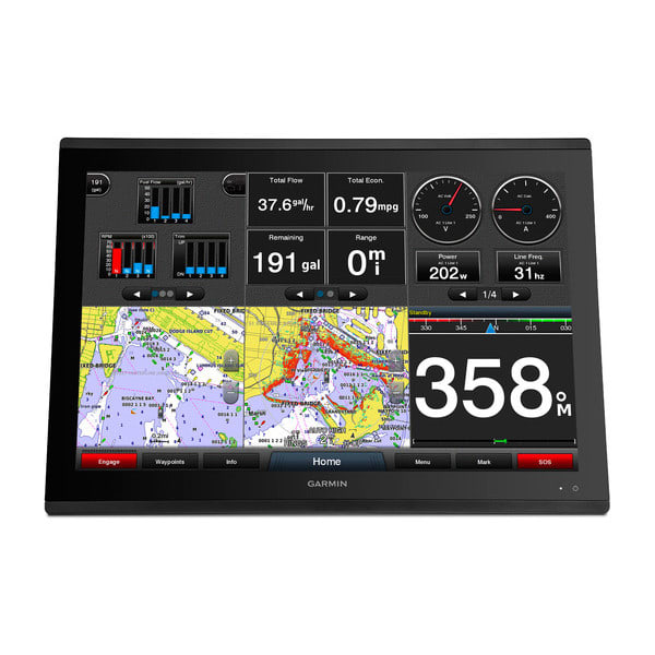
Integrates…everything, including various sonar technologies, integrated autopilot, connectivity, apps, engine data and multi-media. SmartMode™ control allows the user to quickly change all screens at a helm in sync to a preset mode. Everything you need is at the tip of your finger, all on one screen.
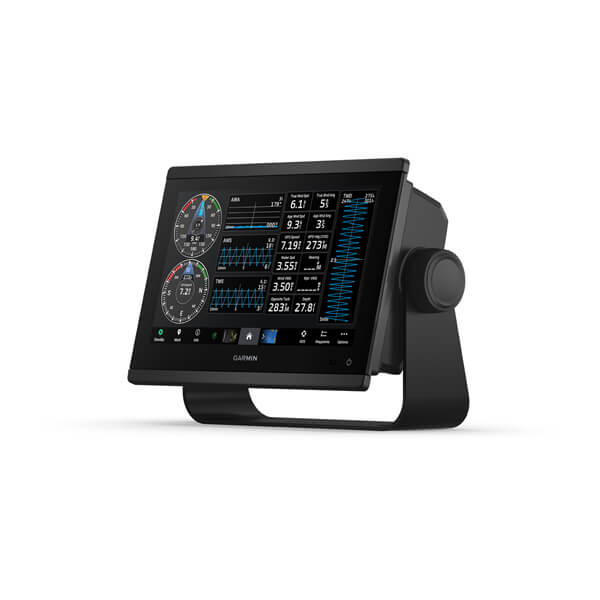
SmartMode control allows you to switch all monitors in sync from one mode to another without manually switching each monitor separately. Fully customisable layouts, data and gauges allow you to place the information you need to see right where you want it.
External GPS19x smart antenna with 10 Hz GPS/GLONASS receiver updates position and heading 10 times per second to display a more fluid vessel movement and dramatically improves your ability to accurately mark and navigate to 5,000 waypoints.
A remote device that provides full control of all GPSMAP 8000 Glass Helm series units. Rotary knob and joystick controls provide navigation through menus and screens and allows you to seamlessly navigate between monitors at a station. Control single or multiple monitors with one device. Supports multiple devices per station. Small footprint can be integrated into a captain’s chair (sold separately).
This combo allows you to add more capabilities to your boat. It provides NMEA 2000 support so you can see valuable information on your screen for Garmin autopilot, engine data and more.
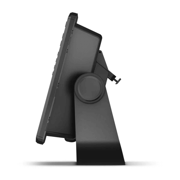
The 8008 MFD is compatible with the traditional bail mount, or you can step up to the low-profile flush mount. For the ultimate in custom appearance, check out our exclusive flat-mount glass helm option.
Just enter the location where you want to go and patented Garmin Auto Guidance technology instantly searches through relevant charts to create a safe virtual pathway on the display that helps you avoid low bridges, shallow water and other charted obstructions en route.
Better still, with enhanced Version 2.0, you now have access to even more features and capabilities. You’re able to adjust the calculated Auto Guidance pathway by inserting “via” points at interim stops or landmarks along your desired route. You can easily review hazard points along your calculated path. And you can even engage your compatible Garmin autopilot to follow the Auto Guidance route, automatically. Other 2.0 enhancements give you the ability to calculate arrival times at any point on your route (great for timing arrivals to correspond with bridge openings and other time-critical events). Better still, you can now save your plotted Auto Guidance paths for future navigation by backing them up on an SD™ card with your BlueChart® g2 Vision® or Lake Vü™ HD Ultra cartography¹.
This exclusive SOS safety assist feature makes it easier for anyone – even those not familiar with marine electronics or radio protocols – to quickly call for Coast Guard help in an emergency. By simply tapping the SOS button on the chartplotter’s touchscreen display, your networked Garmin VHF radio will automatically tune to the Channel 16 emergency frequency and a list of possible situations (Ffire, man overboard, etc.) will be displayed. Once the applicable choice has been selected, the screen will provide a Coast Guard approved VHF radio distress call script, along with the ship’s current lat/long GPS coordinates, that can be read off to responders – thus saving time, averting panic, and providing the essential information needed by rescuers to assure the best possible outcome.
If you have waypoints, tracks or frequently used routes stored on another manufacturer’s GPS product – or on a Garmin handheld device – now it’s easier than ever to transfer those items to your new Garmin chartplotter, via industry-standard GPX software formatting. GPX is an open standard format for GPS data exchange across platforms and applications. With this easy-to-use interface technology, Garmin has taken “no waypoint left behind” to a whole new level of trade-up convenience.
To help you gain a wind-maximizing competitive edge, your chartplotter features a pre-race guidance page that shows your virtual starting line, along with data fields showing laylines, time to burn before the start and a race timer that can be synchronized across all your networked Garmin GPS products. In addition, other supported sailing features include an enhanced wind rose, heading and course-over-ground lines, set and drift, true and apparent wind data and more. You can also use available built-in wireless connectivity to access and control a variety of marine-specific apps via compatible smartphones or tablets.
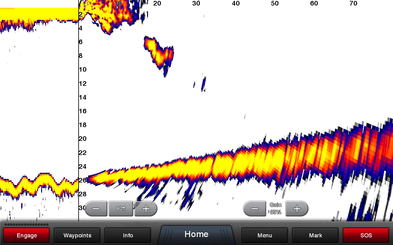
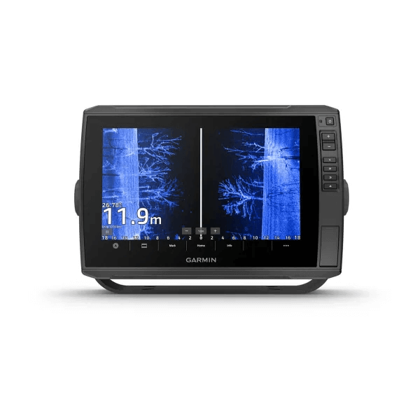
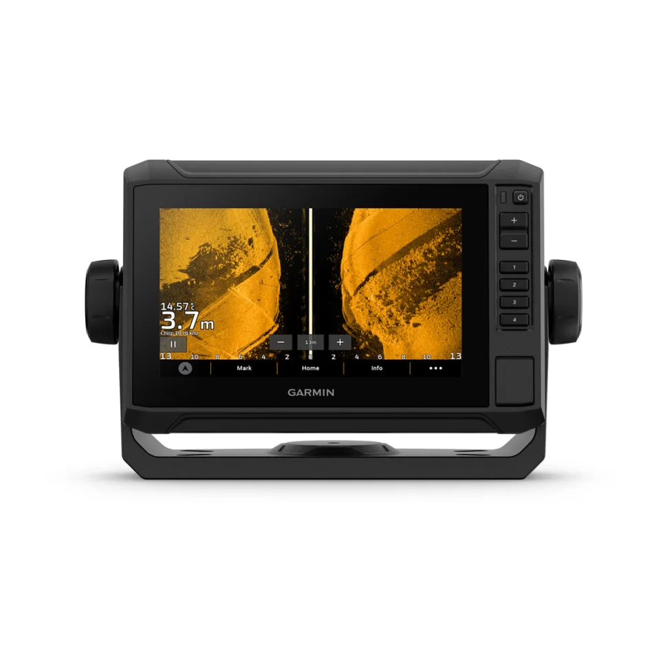
With 1 Panoptix Down transducer, you get 3 remarkable views, allowing you to actually see fish and bait swimming around under your boat – in real time. You can even see fish in the water column in 3-D, from the bottom to the surface. You can be stationary yet still see things in 3-D below your boat.
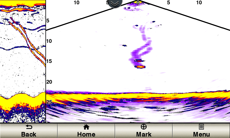
Shows real-time moving sonar images below the boat. This screen shows bait drop echo trail movement in purple with sonar history data at left.
Scans the area below the boat from front to back and side to side. This screen shows a school of fish sitting against the back side of vertical face, on Pport side of boat 35 feet deep.
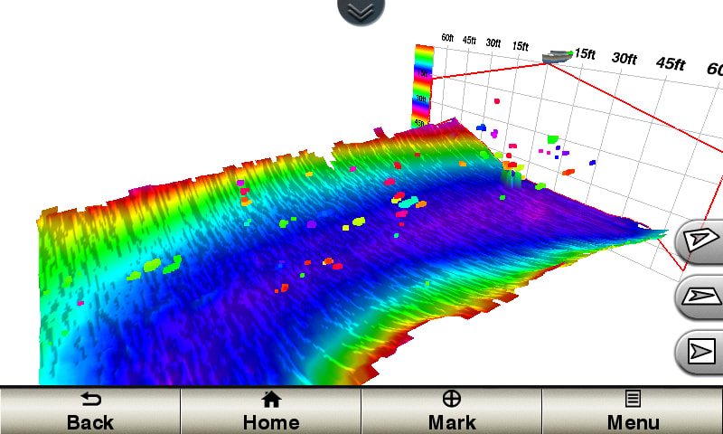
Scrolls through the data as the boat moves to show the history of entire water columns – from the bottom to the surface and all of the fish in between. This screen shows the boat passing over a stream channel with a school of fish between 30 to 40 feet.
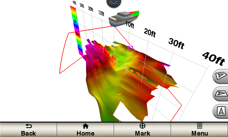
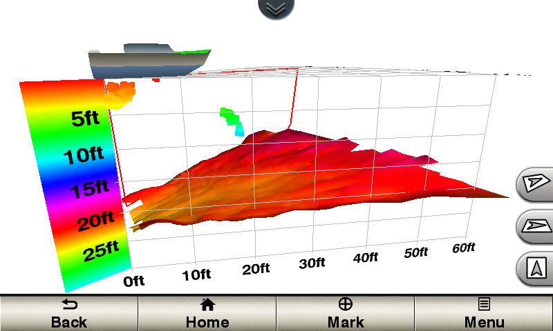
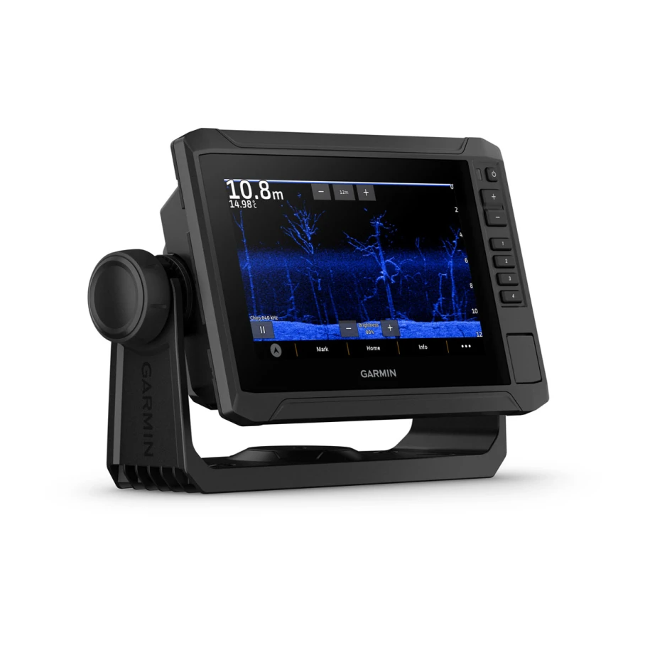
One Panoptix Forward transducer provides 2 impressive views, even while your boat is stationary. It shows the bottom plus fish and bait swimming in the water column in front of your boat – in real time. You can even see your lure as you reel it in. You can also get 3-D views of fish and structure in front of your boat.
Updates are provided with a single ping, providing real-time moving images of what’s in the water. This screen shows a large target (a diver) approaching the boat.
Digitally scans the area in front of the boat, creating a forward-looking 3-D view of the bottom, structure and fish. This screen shows fish targets at 10 feet and drawing bottom depth of 20 feet.
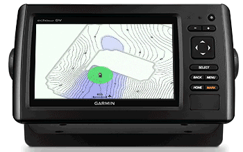
Quickdraw Contours is a free, easy-to-use software feature that is already installed on your Garmin. It instantly creates your very own personalised HD fishing maps with 1 foot contours. Tailor them to fit your needs. They’re your maps. You own them. Keep the data to yourself or share it with the Quickdraw Community on Garmin Connect™. There’s no special surveying expertise required. You just fish while it creates maps. You don’t have to wait around or send your files away like other mapping software requires — your results appear instantly. Use with any Garmin Panoptix™, any HD-ID™, any CHIRP-enabled, Garmin ClearVü™ transducer or NMEA 2000®-compatible depth transducer. Have more than 1 sonar device installed onboard? Quickdraw Contours automatically selects the most capable sonar device to provide the very best results for you!

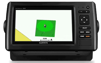
Designate up to 10 different depth ranges each with its own colour. Makes it easier to view target depths at a glance.
To make commissioning easier and more convenient, you can handle the entire autopilot commissioning process from your chartplotter screen.
This chartplotter supports wireless connections to Garmin VIRB® action cameras so you can catch all the action during your time on the water. More importantly, with a simple software update, you can control recordings, take still pictures, and stream video from a VIRB action camera to your GPSMAP® 7400 series chartplotter or 8000/8400 series Glass Helm chartplotter. In fact, you can stream video from up to 4 VIRB action cameras and view the video on a compatible marine chartplotter. You can even view previously captured images and videos on the chartplotter and display thumbnail previews for easy selection. Control play, pause, seek and replay from your chartplotter. There’s even an automatic slide show mode and the ability to delete unwanted VIRB images or videos. Each VIRB can be named for easy identification. You can also control your VIRB cameras to change VIRB video settings, including aspect ratio, video resolution, frames per second, photo size, field of view and more — directly from the marine chartplotter. Send NMEA 2000 boat information from the chartplotter to VIRB to be overlaid as G-Metrix™ data on the video using VIRB Edit or the VIRB mobile app. Some data requires optional accessories.
| Series | |
|---|---|
| Version | MFD |
General |
|
| Dimension | 26.89 x 19.39 x 11.56 cm (10 9/16″ x 7 5/8″ x 4 9/16″) |
|---|---|
| Weight | 5.1 kg (11.3 lb) |
| Water rating | IPX7 |
| Display Type | Touchscreen SVGA display (anti-glare finish) |
| Display Size | 17.1 x 13 cm, 21.3 cm diagonal (6.8″ x 5.1″, 8.4″ diagonal ) |
| Display Resolution | 800 x 600 pixels |
| Mounting Options | Bail, flat or flush |
Maps & memory |
|
| Accepts Data Cards | 2 SD™ cards (Garmin Card Reader required) |
|---|---|
| Waypoints | 5,000 |
| Navigation Routes | 100 |
Sensors |
|
| Receiver | 10 Hz high-sensitivity |
|---|---|
| NMEA 2000® compatible | |
| NMEA 0183 Compatible | |
Chartplotter features |
|
| Garmin SmartMode compatible (customisable monitor presets) | |
|---|---|
| AIS | |
| DSC | |
| Supports Fusion-Link™ compatible radios | |
| GSD Black Box Sonar Support | |
| GCV Black Box Sonar Support | |
| ActiveCaptain Mobile Planning Compatible | Yes (Wi-Fi Adapter Kit required, sold separately) |
| GRID (Garmin Remote Input Device) compatible | |
Connections |
|
| Connections NMEA0183 Input Ports | 4 |
|---|---|
| Video input ports | 2 – BNC composite |
| Video output ports | 1 – DVI-I |
| Garmin Marine Network Ports | 4 |
Additional |
|
| Additional |
Wifi can only be used with the below compatible Garmin apps.
|
|---|---|
What’s in the box:
GPSMAP 8008
Bail mount and knobs
GPS 19x NMEA 2000® (with pole mount, flush mount and under deck mount adapters)¹
Garmin card reader¹
Protective cover
Flush mount gasket and hardware
Power cable
NMEA 0183 cable
NMEA 2000 2 m (6.5 ft) backbone/drop cable
NMEA 2000 power cable
NMEA 2000 T-connector & terminator kit
Manual case with documentation
102sv with GT56UHD-TM Transducer
Non-sonar with Worldwide Basemap

GARMIN GPSMAP 723XSV, WORLDWIDE W/ GMR 18HD+
72sv with GT54UHD-TM Transducer
With Worldwide Basemap and Sonar
102sv with GT56UHD-TM Transducer
Non-sonar with Worldwide Basemap
GARMIN GPSMAP 723XSV, WORLDWIDE W/ GMR 18HD+
72sv with GT54UHD-TM Transducer
With Worldwide Basemap and Sonar
102sv with GT56UHD-TM Transducer
Non-sonar with Worldwide Basemap
GARMIN GPSMAP 723XSV, WORLDWIDE W/ GMR 18HD+