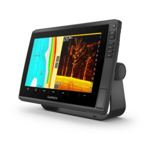
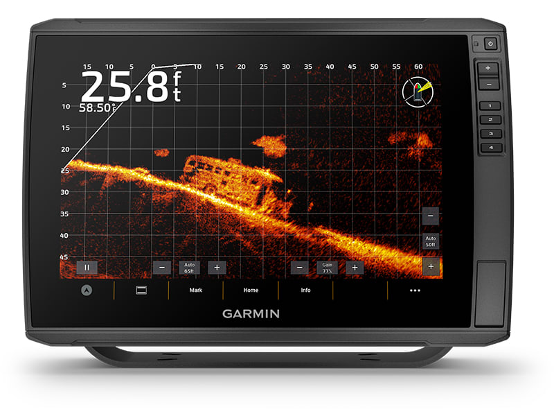
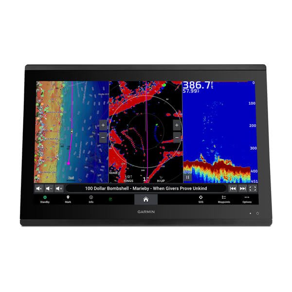
With big, crisp, sunlight-readable touchscreen displays, these versatile chartplotters put a world of fishfinding capability at your fingertips. They support Garmin Navionics+™ and Garmin Navionics Vision+™ mapping and the transducer bundle adds Ultra High-Definition scanning sonars as well as CHIRP traditional sonar.

10” OR 12” TOUCHSCREENS

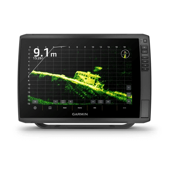
SUPPORTS LIVESCOPE™ SONAR1 AND MORE

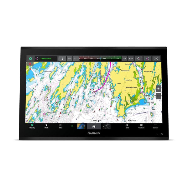
SUPPORTS GARMIN NAVIONICS+™ AND GARMIN NAVIONICS VISION+™ MAPPING

WIRELESSLY – SHARE SONAR, WAYPOINTS AND ROUTES2

CAPTURE SCREEN RECORDINGS TO SHARE FISH CATCHES

MULTI-BAND GPS FOR IMPROVED POSITION ACCURACY
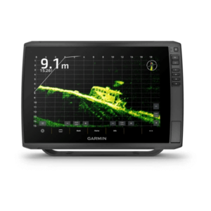
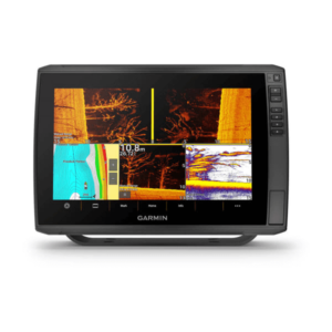
The ECHOMAP Ultra 2 series supports the full lineup of LiveScope live-scanning sonar products (transducers sold separately).
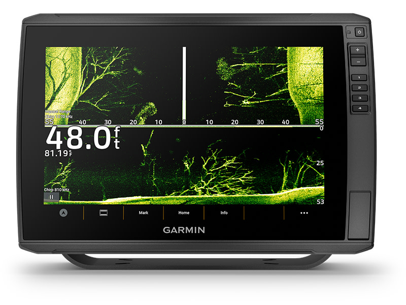
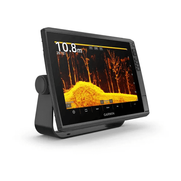
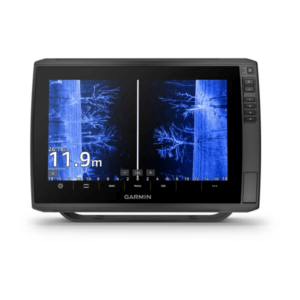
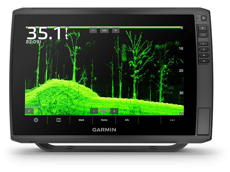
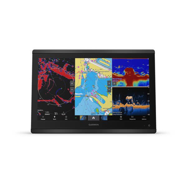
Select models are bundled with a GT56 transducer which provides Garmin CHIRP traditional sonar and Ultra High-Definition ClearVü™ and SideVü™ scanning sonars for photo-like images of what’s beneath the surface.
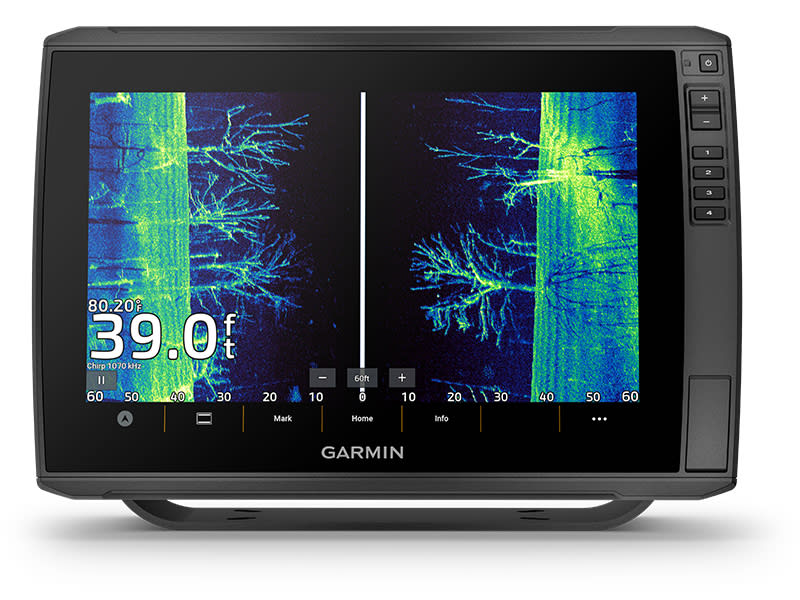
High-contrast vivid scanning sonar colour palettes make it easier than ever to distinguish targets and structure.
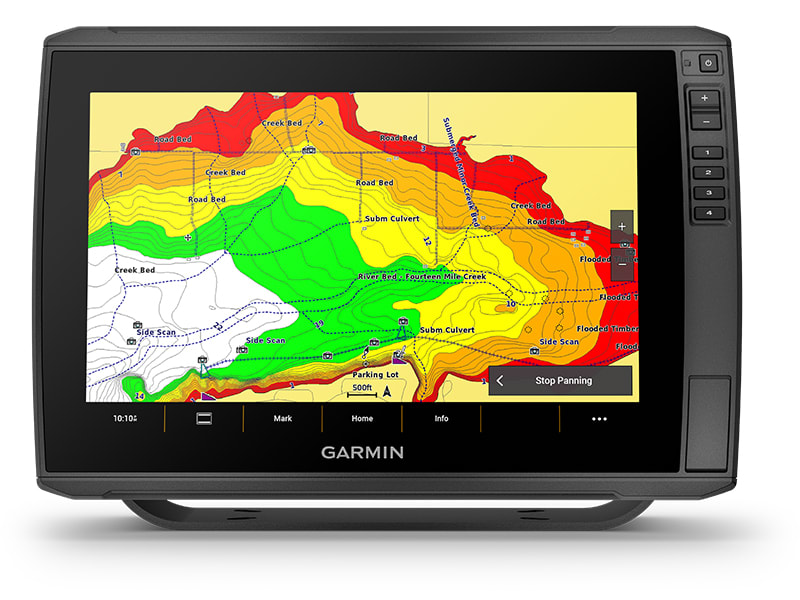
Bring a fresh new look and feel to your chartplotter with optional Garmin Navionics+™ or premium Garmin Navionics Vision+™ cartography featuring integrated coastal/inland content, access to daily updates, Auto Guidance+™ technology and more.
If you have another compatible ECHOMAP Ultra 2 or ECHOMAP UHD2 chartplotter on your boat, you can wirelessly share information — such as sonar3, waypoints and routes — with them.
Get improved position accuracy with multi-band GPS

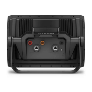
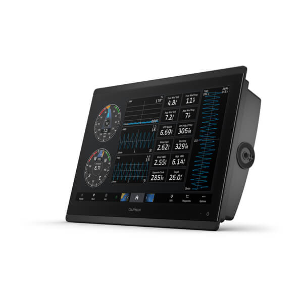
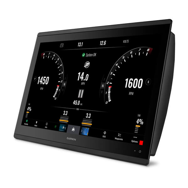
Connect to heading sensors, autopilots, Fusion-Link™ audio systems and more.

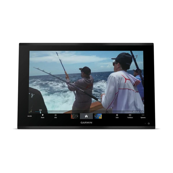
Pair with the free smart-device app for software updates, screen recording, Garmin Quickdraw™ Community data and more4.

Wirelessly connect to your Force trolling motor to navigate to waypoints, draw and follow routes, and more.

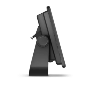
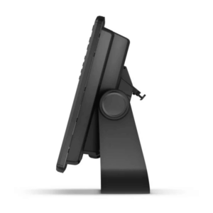
The quick-disconnect bail mount lets you quickly install and remove your unit.
| Series | |
|---|---|
| Display Size | 12" |
| Includes Transducer | Yes |
With transducer
ECHOMAP Ultra 102sv
GT56UHD-TM transducer
Charging/data cable
Bail Mount With Quick Release Cradle
Protective sun cover
Hardware
Documentation
Without Transducer
ECHOMAP Ultra 102sv
Charging/data cable
Bail Mount With Quick Release Cradle
Protective sun cover
Hardware
Documentation
General |
|
| Dimension | 29.5 x 19.5 x 9.8 cm (11.6″ x 7.7″ x 3.9″) |
|---|---|
| Weight | 1.8 kg (4 lbs) |
| Waterproof | IPX7 |
| Touchscreen | |
| Display Type | WXGA, IPS |
| Display Size | 21.7 x 13.6 cm; 21.7 cm diagonal (8.5″ x 5.4″; 10″ diagonal) |
| Display Resolution | 1280 x 800 pixels |
| Mounting Options | Bail or flush |
| Input | Touchscreen with Keyed Assist |
Maps & memory |
|
| Accepts Data Cards | 2 microSD Cards |
|---|---|
| Waypoints | 5000 |
| Track points | 50,000 |
| Tracks | 50 saved tracks |
| Navigation Routes | 100 |
Sensors |
|
| GPS | |
|---|---|
| GLONASS | |
| Galileo | |
| BeiDou | |
| Has built-in receiver | |
| Receiver | 10 Hz |
| NMEA 2000® compatible | |
| Supports WAAS | |
| Supports multi-band, multi-constellation GPS | |
Built-in maps |
|
| Built-in Auto Guidance+ | |
|---|---|
| Garmin Navionics+ Inland & Coastal | Yes (see Additional) |
| Tide tables | Yes (see Additional) |
Optional map support |
|
| BlueChart g3 | |
|---|---|
| BlueChart g3 Vision | |
| Garmin Navionics+™ | |
| Garmin Navionics Vision+™ | |
| TOPO 100K | |
| Standard Mapping | |
| Garmin Quickdraw Contours | |
Chartplotter features |
|
| AIS | |
|---|---|
| DSC | |
| Supports Fusion-Link™ compatible radios | |
| ActiveCaptain Mobile Planning Compatible | |
| Sailing features | |
Electrical features |
|
| Power Input | 9 to 18 Vdc |
|---|---|
| Typical current draw at 12 Vdc | 2.3 A |
| Maximum current draw at 12 Vdc | 5 A |
| Maximum power usage at 10 Vdc | 34 W |
Sonar features & specifications |
|
| Displays sonar | |
|---|---|
| Power output | 600 W |
| Traditional sonar (dual frequency/beam) | built-in (single channel CHIRP, 70/83/200 kHz, L, M, H CHIRP) |
| ClearVü | Built-in 260/455/800/1000/1200 kHz |
| SideVü | Built-in 260/455/800/1000/1200 kHz |
| Panoptix™ sonar | |
| LiveScope | |
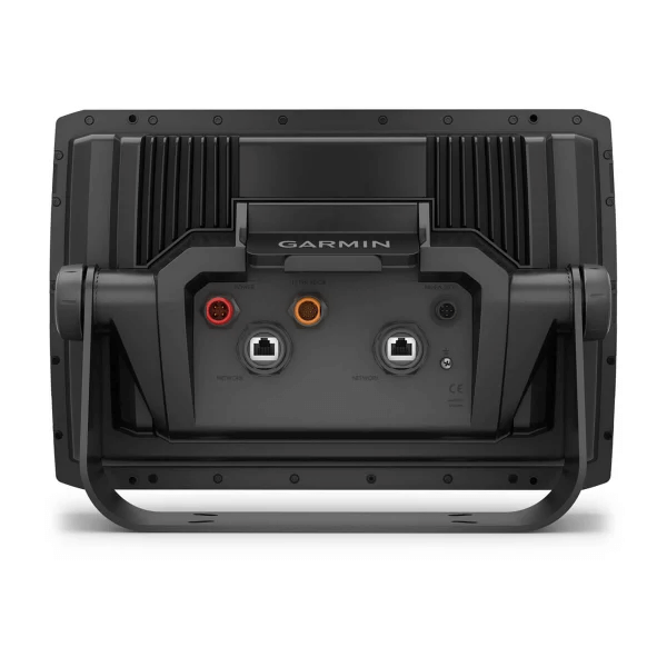
Connections |
|
| NMEA 2000® ports | 1 |
|---|---|
| Garmin Marine Network Ports | 2 (large connector) |
| 12-pin transducer ports | 12-pin scanning sonar |
| ANT+ (Connectivity) | |
| Garmin Wi-Fi network (local connection) | |
Premium chartplotter with worldwide basemap
With Worldwide Basemap and Sonar
With Worldwide Basemap and Sonar

GARMIN GPSMAP 723XSV, WORLDWIDE W/ GMR 18HD+
Premium chartplotter with worldwide basemap
Premium chartplotter with worldwide basemap
With Worldwide Basemap and Sonar
With Worldwide Basemap and Sonar
GARMIN GPSMAP 723XSV, WORLDWIDE W/ GMR 18HD+
Premium chartplotter with worldwide basemap
Premium chartplotter with worldwide basemap
With Worldwide Basemap and Sonar
With Worldwide Basemap and Sonar