2 ITEMSView cart
-
Big Mouth Beverage Boats Tropical Birds 1 × 51.00


Your order qualifies for free shipping!
Subtotal: 7,580.00

Subtotal: 7,580.00

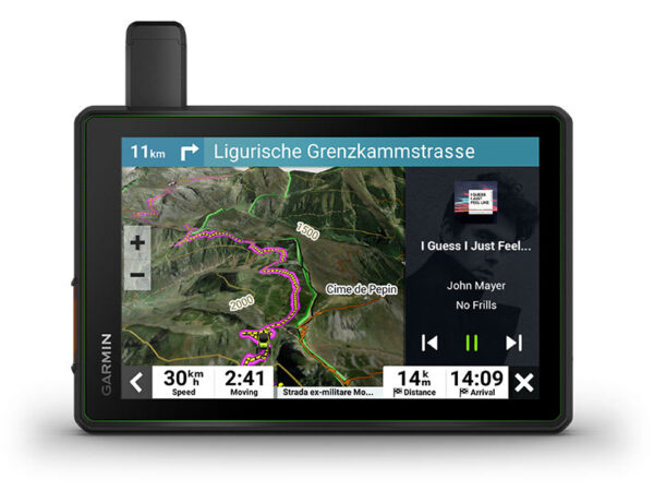
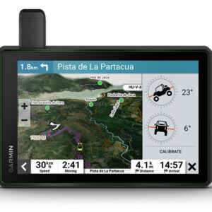
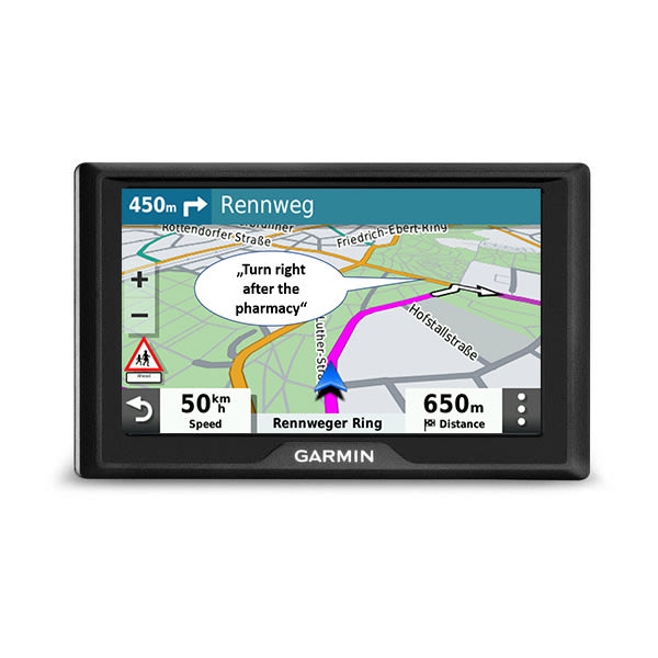
Hit the trails and have fun with your friends with this rugged powersport sat nav. It has all the mapping you need to stay on track and communication technology to stay in touch while you’re out there.

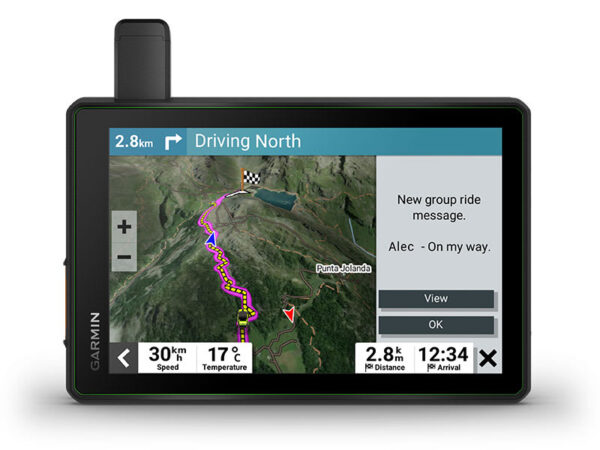
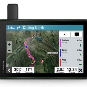
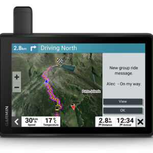
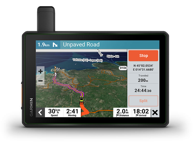
Keep your crew together with group tracking for up to 20 riders1.

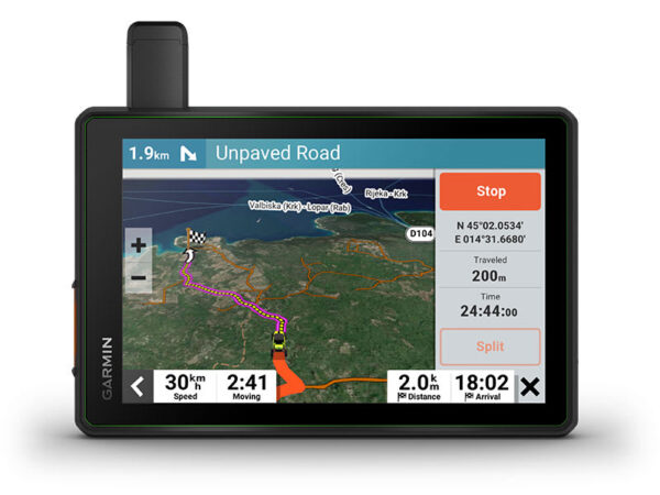
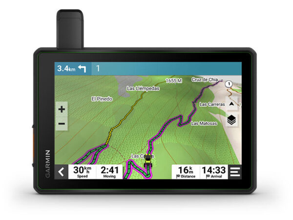
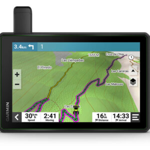
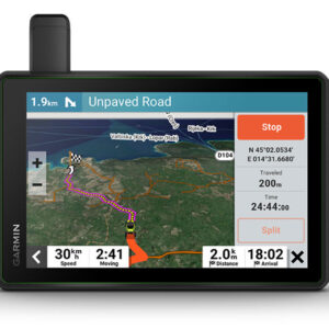
Navigate unpaved roads and trails by using turn-by-turn trail navigation2 with OpenStreetMap (OSM).

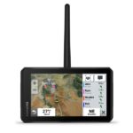
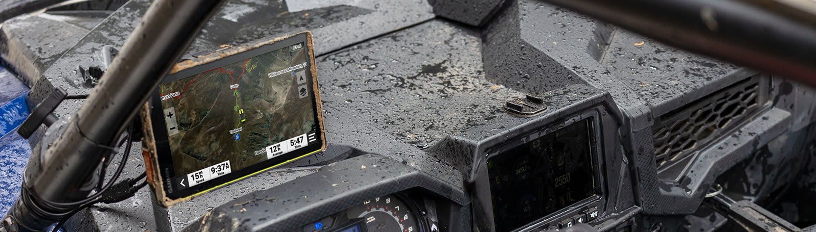
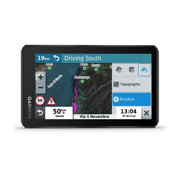
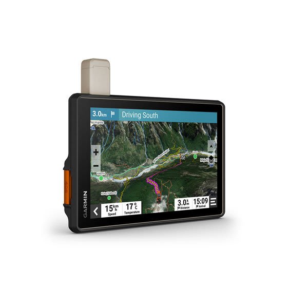
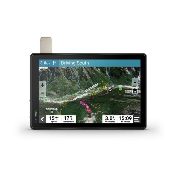
This rugged sat nav is IP67 weather-resistant and has a glove-friendly 8″ touchscreen display.

See vivid aerial views of terrain with downloadable, subscription-free BirdsEye Satellite Imagery.

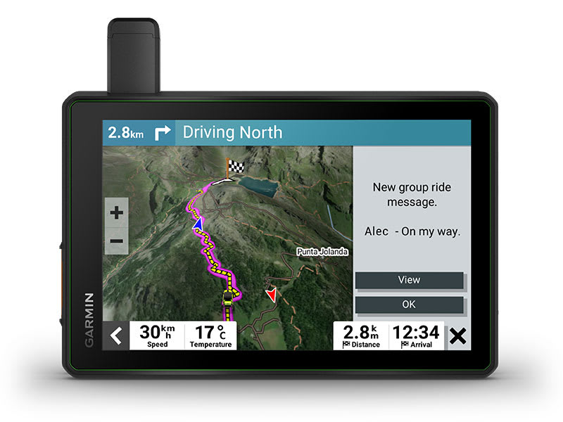
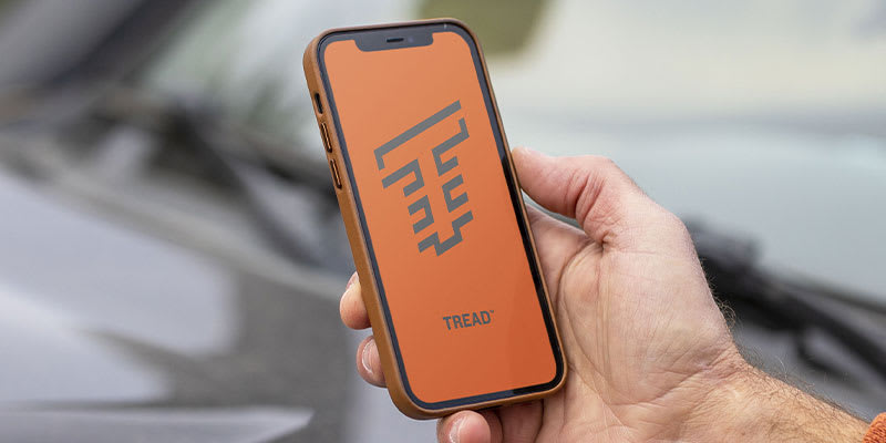
Use the Tread® app on your compatible smartphone for the Group Ride Mobile feature3, easy route planning and more.

Peace of mind comes built-in. With an active subscription, you can use inReach® technology for global satellite communication4.
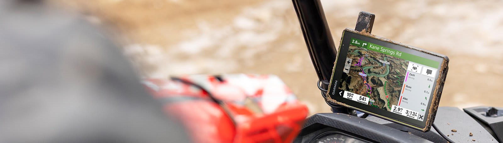
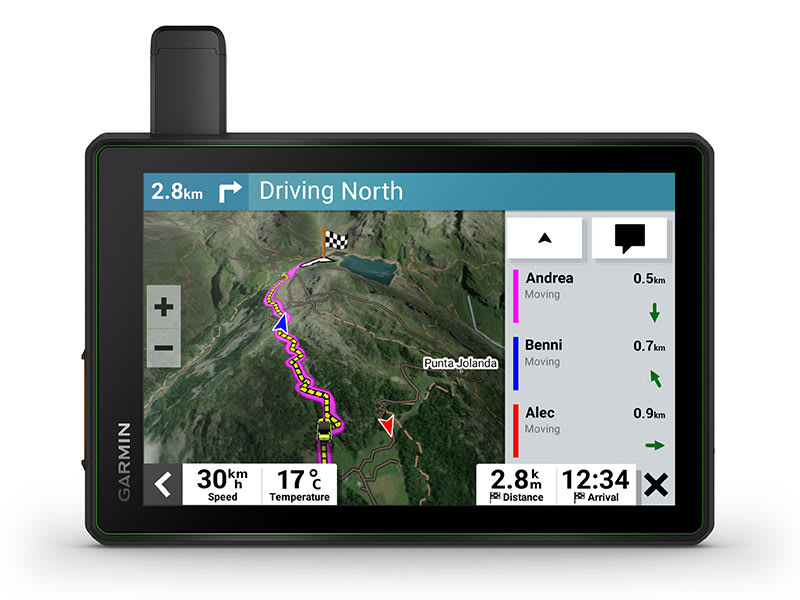
The included Group Ride Tracker allows tracking for up to 20 riders with no mobile phone coverage needed. Plus, location sharing and pre-defined messaging 1 lets you easily stay connected with your Group Ride friends.
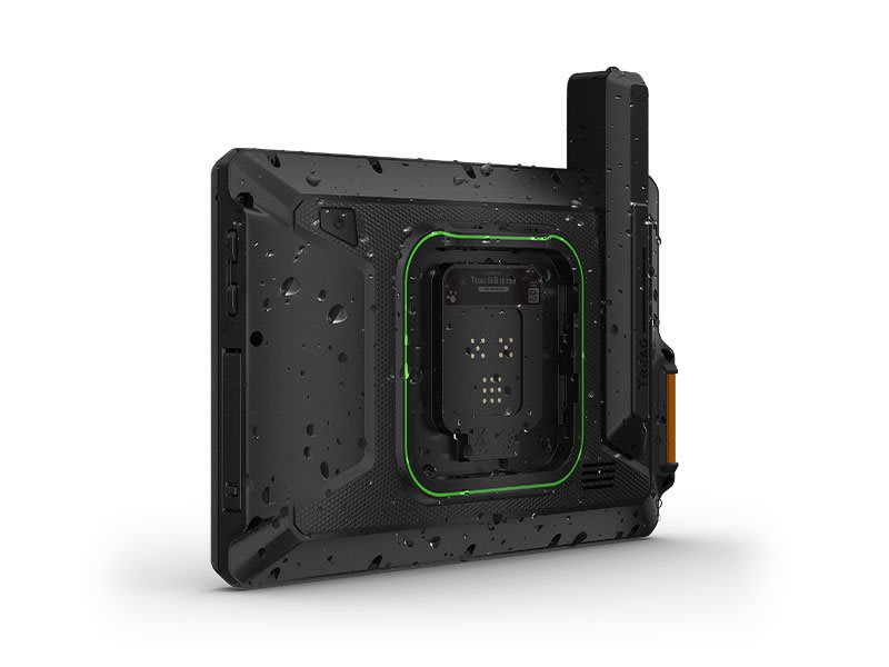
Purpose-built for all-terrain use, this Tread device stands up to anything the elements can throw at it. It’s IP67-rated for water-resistance and built to U.S. military standard 810G for thermal and shock resistance.
With its ultrabright 8″ glove-friendly touchscreen, the sat nav is designed for easy viewing in bright sunlight or pitch dark. It can be mounted in portrait or landscape mode.

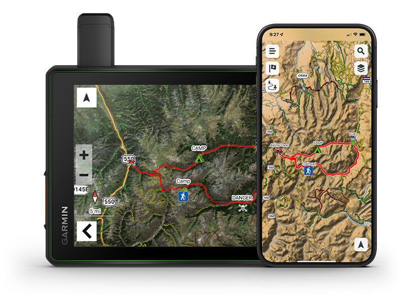
Enjoy turn-by-turn trail navigation 2 for traversing unpaved roads and trails using adventure roads and trails map content comprised of OSM.
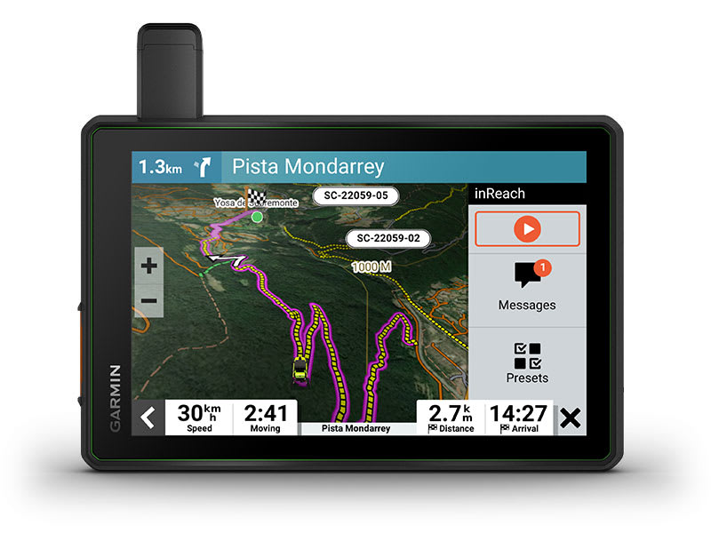
Built-in inReach technology offers global satellite communication, two-way text messaging, location sharing, interactive SOS and weather updates 4 .

Tread features preloaded topographic maps with 3D terrain and street maps for Europe, Africa including Tracks4Africa and Middle East. It also includes the Garmin Adventurous Routing™ option to take the most hilly, curvy and unpaved roads. North and South America, Australia and New Zealand are available as free downloads via garmin.com/express. garmin.com/express.
Enjoy vivid aerial views when you download high-resolution BirdsEye Satellite Imagery directly to your device via Wi-Fi® connectivity, with no annual subscription required.
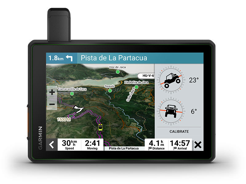
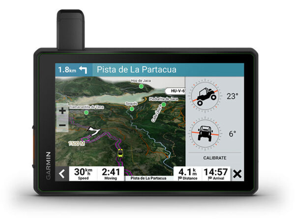
When you’re headed to tough-terrain, the built-in sensors will come in handy — including an altimeter, barometer, compass and pitch/roll gauges.
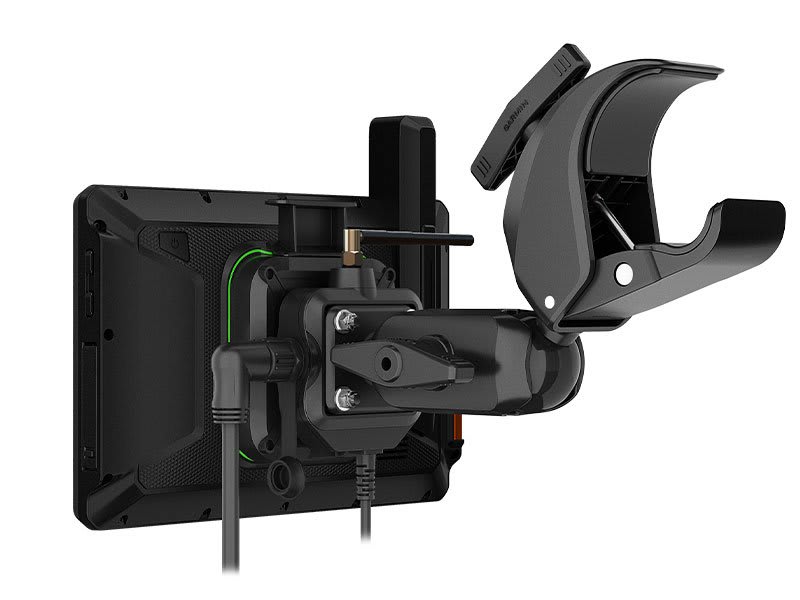
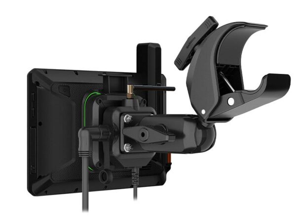
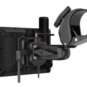
The included locking magnet-assisted mount and tube mount secure your Tread sat nav to your powersport vehicle for riding over rough terrain.
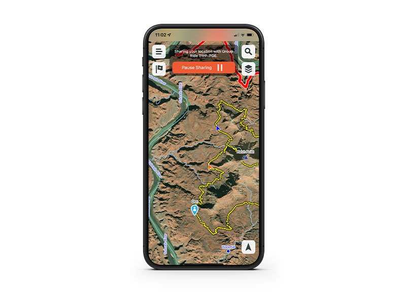
Pair your device with the Tread app to track your friends from your phone using the Group Ride Mobile feature 3 .
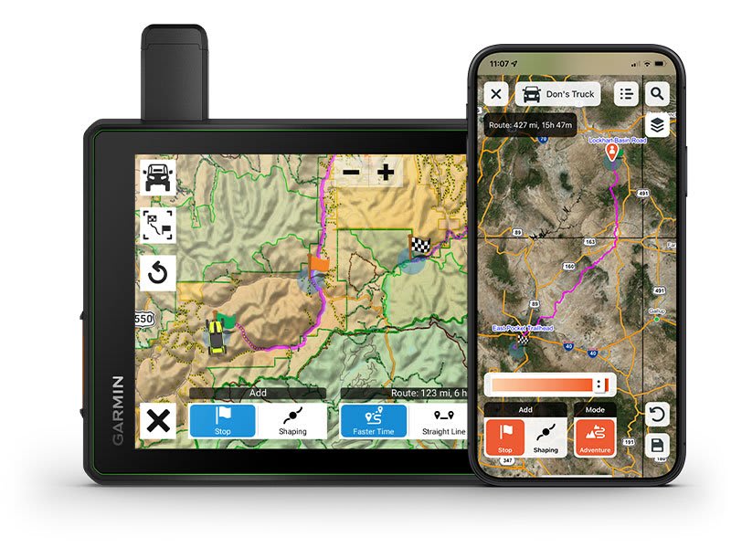
Use the Tread app to easily plan routes with the same maps, vehicle profiles and route preferences that you have on the Tread device.
Use the Tread app to sync waypoints, tracks, routes and collections across all your devices. Easily import and share GPX files, too.

Weather ahead? Pair your Tread device with your compatible smartphone, and download the Tread app to access live weather, storm alerts, animated radar and more.
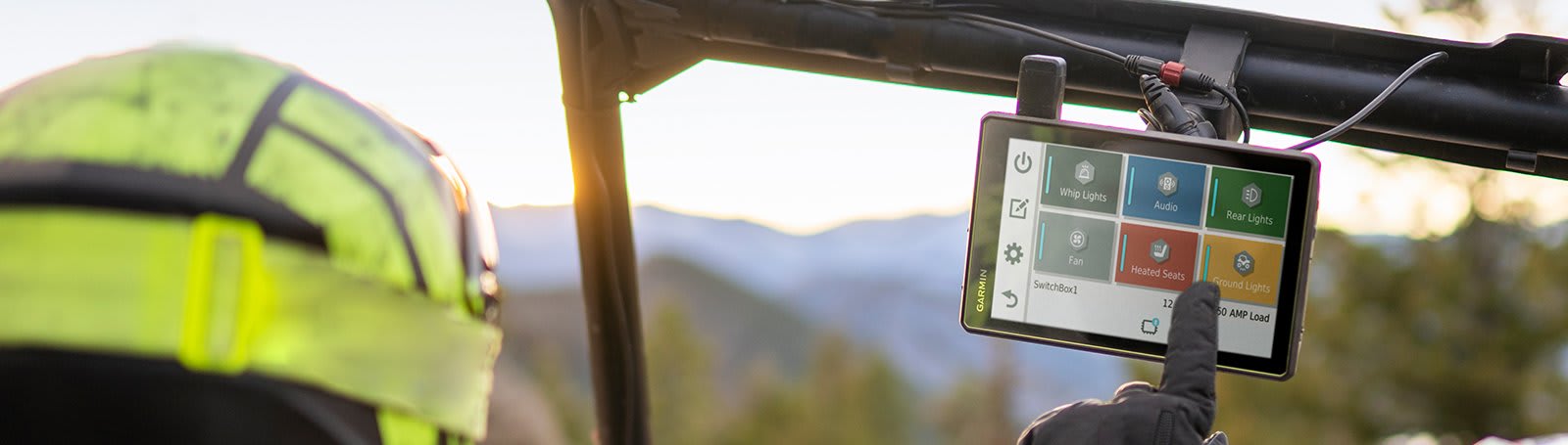
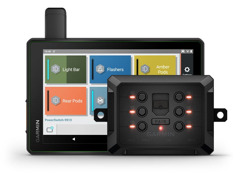
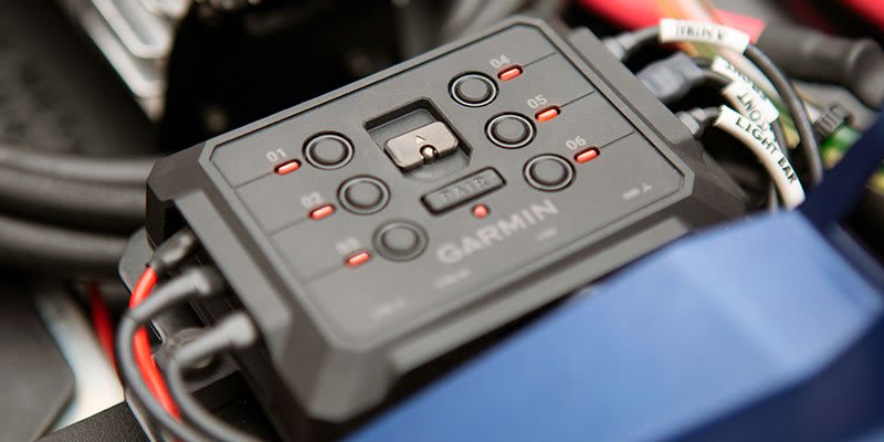
Pair Tread with the compatible Garmin PowerSwitch™ digital switch box (sold separately) to enable on-screen control for your vehicle’s 12-volt electronics — light bars, differential locks and more.
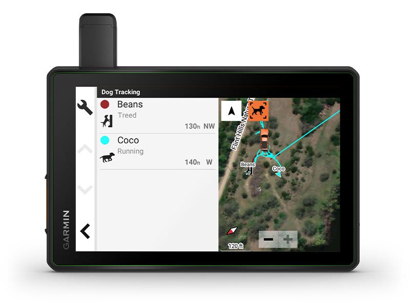
Wirelessly pair Tread with select Garmin GPS dog trackers (sold separately) to help track and retrieve your sporting dogs in the field. You’ll see markers for each dog within tracking range, overlaid right on the sat nav’s map screen.
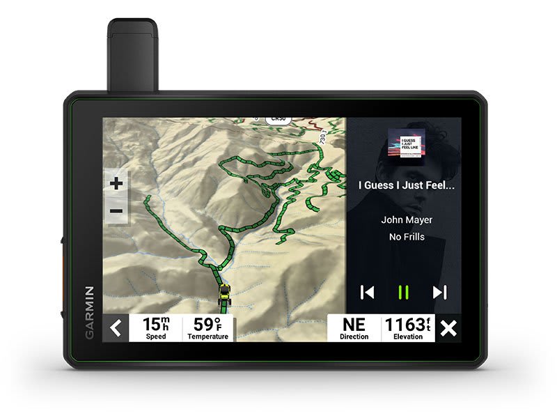
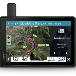
A built-in media player lets you easily control music loaded on your compatible smartphone on the sat nav’s display — and hear your tunes through your helmet or headset (not included) enabled with Bluetooth technology.
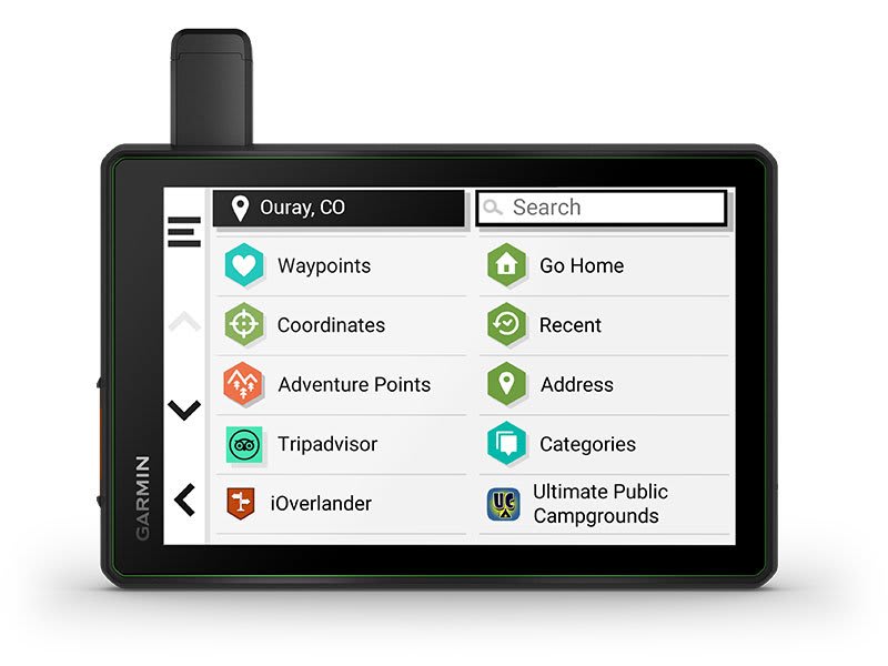
Tread comes preloaded with iOverlander™ points of interest so you don’t need a cell signal to route to the best-established, wild and dispersed campsites.
| Series | |
|---|---|
| Activity | Powersport |
| Screen Size | 8 |
| Includes Group Ride Tracker | Yes |
General |
|
| Dimension | 8.1″W x 6.7″H x 1.2″D (20.7 x 16.9 x 3.1 cm) |
|---|---|
| Display Size | 6.8″W x 4.2″H (17.2 cm x 10.8 mm); 8″ diagonal (20.3 cm) |
| Display Resolution | 1,280 x 800 pixels |
| Display Type | Multi-touch, glass, high brightness HD colour TFT with white backlight |
| Dual-orientation display | |
| Weight | 22.8 oz (246 g) |
| Battery type | Rechargeable lithium-ion |
| Battery life | Up to 6 hours at 50% backlightUp to 1 hour at 100% backlight |
| Water rating | IPX7 |
| Drop rating | MIL-STD-810 |
| Dust rating | IP6X |
| Magnetic Mount | Locking magnet-assisted mount |
| Tube mount (1.5″ – 2.375″) | |
| 1.5″ ball adapter with AMPS plate | |
Maps & memory |
|
| Preloaded street maps | |
|---|---|
| Data cards | microSD™ card (not included) |
| 3D Terrain | |
| INTERNAL STORAGE | 64 GB |
| Ability to add maps | |
| STORAGE AND POWER CAPACITY | yes (256 GB max microSD™ card) |
| INCLUDES MAP UPDATES | |
| Downloadable Satellite Imagery | Yes (BirdsEye) |
Sensors |
|
| GPS | |
|---|---|
| Galileo | |
| 10 Hz multi-GNSS positioning | |
| Barometric altimeter | |
| Compass | |
Outdoor recreation |
|
| Point-to-point navigation | |
|---|---|
| PRELOADED TOPOGRAPHIC MAPS | |
| Navigate-a-track navigation | |
| Turn-by-turn trail navigation | |
Navigation Features |
|
| Garmin Real Directions™ landmark guidance | |
|---|---|
| TRIPADVISOR® TRAVELLER RATINGS | |
| Route shaping through preferred cities/streets | |
| TRAFFIC UPDATES | Yes (with Garmin Tread app) |
| Lane assist with junction view (displays junction signs) | |
| Bluetooth® calling | yes (works with BLUETOOTH-compatible helmet, headset or smartphone; BLE capable) |
| Speed limit indicator (displays speed limit for most major roads) | |
| ENVIRONMENTAL ZONES ROUTING | |
Advanced Features |
|
| SMART NOTIFICATIONS VIA APP | |
|---|---|
| Wi-Fi® map and software updates | |
| ACCESS TO LIVE SERVICES VIA APP | |
Motorcycle features |
|
| Glove-friendly touchscreen | |
|---|---|
| Control music and media from smartphone or MP3 player | |
| Sunlight readable and weather resistant | |
| Garmin Adventurous Routing™ | |
| Motorcycle or powersports specific points of interest for cycle repair services, dealers and more | |
| Elevation profile | |
| Round trip routing | |
| Service History Log | |
| Custom map support | |
| TOPO map support | |
Camper Features |
|
| Specialised routing for the size and weight of your vehicle | |
|---|---|
| Camper Sites & Services Directory | |
| Road elevations | |
| Speed limit changes | |
| Easy Route Planner with GPX file sharing | |
Adventure features |
|
| Built-in inReach® Technology (requires active subscription; subject to regulations or prohibitions in some jurisdictions) | |
|---|---|
| Pair with Garmin PowerSwitch™ digital switch box | |
| Compatible with Group Ride Tracker | Yes (included) |
| Compatible with external GPS antenna with mount | |
| Compatible with external inReach® satellite antenna | |
| Group Ride Mobile | Yes (with Garmin Tread app) |
| Track recorder (breadcrumbs) | |
| iOverlander™ points of interest | |
| Pitch and roll gauges | |
| Birdseye Satellite Imagery (download via Wi-Fi) | |
Group Ride Radio |
|
| Radio Frequency Band | VHF 169.4125/169.4250/169.4375/169.4500/169.4625 MHz |
|---|---|
| Group Ride Range | Up to 8 miles (13 kilometres) with the antenna mount kit |
| Group Ride Tracking | Up to 20 riders simultaneously |
| Group Ride update rate | 5 seconds |
| Radio transmitted canned messages | |
Outdoor applications |
|
| Dog tracking | Yes (when paired to compatible dog track system) |
|---|---|
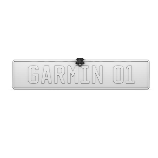
Wireless Backup Camera With Number Plate Mount and Bracket Mount
8” All-Terrain sat nav THIS PRODUCT CANNOT BE SHIPPED TO THE UNITED ARAB EMIRATES.
Wireless Backup Camera With Number Plate Mount and Bracket Mount
8” All-Terrain sat nav THIS PRODUCT CANNOT BE SHIPPED TO THE UNITED ARAB EMIRATES.
Wireless Backup Camera With Number Plate Mount and Bracket Mount