1 ITEMView cart
-
Big Mouth Pool Floats Angel Heart 1 × AED 93.00

Subtotal: AED 93.00


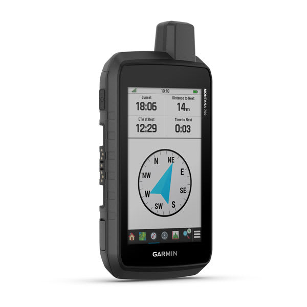
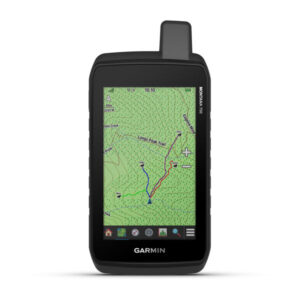
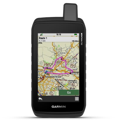
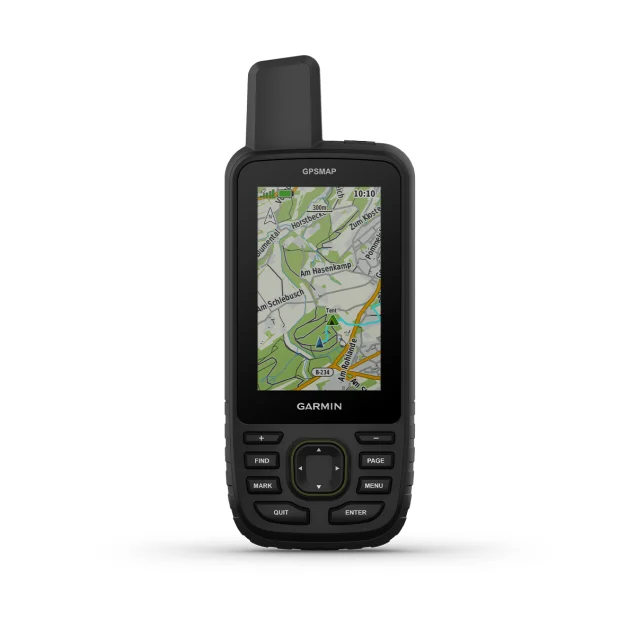
With routable mapping for roads and trails, the Montana 700 handheld brings advanced outdoor features into a sturdy 5” format that’s ideal for navigation on foot, bike, kayak, ATV and more.

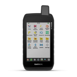
Expect big things. A large touchscreen puts them all at your fingertips.

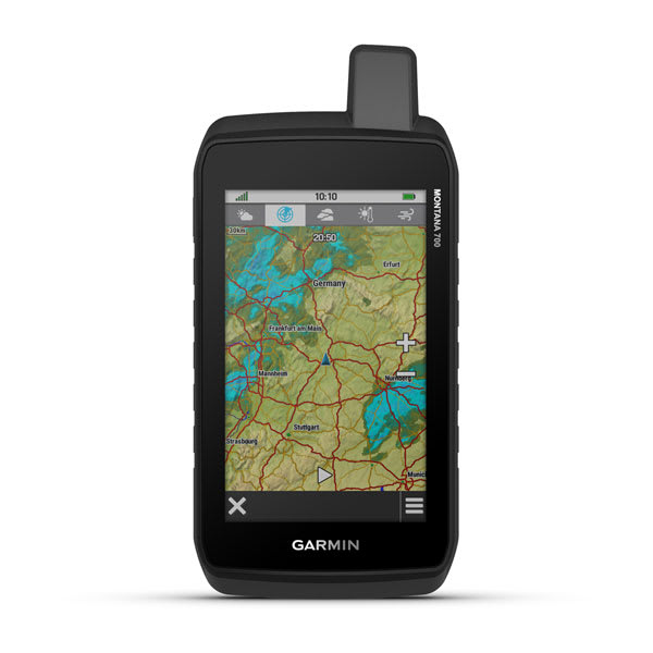
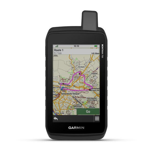
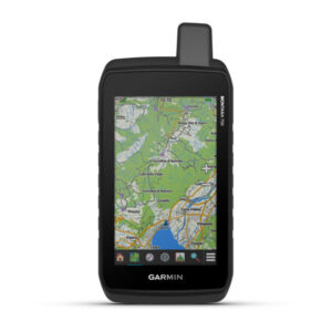
Routable TopoActive Europe maps. Now you’re free to take it off-road or on.

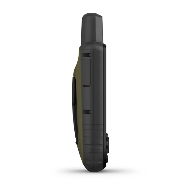
Meets MIL-STD 810 for thermal, shock, water and vibration.

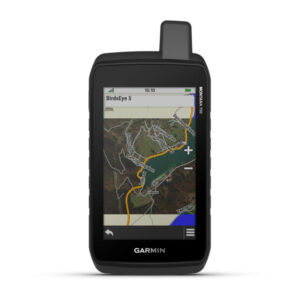
Get the clear perspective of BirdsEye Satellite Imagery right to your device.

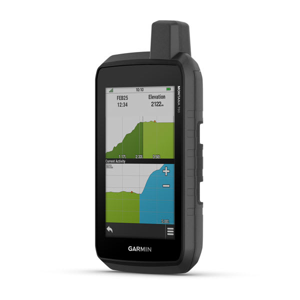
Go far with no fear. ABC sensors and multiple GNSS networks have your back.

Power your adventures with 18+ hours of lithium-ion battery life in GPS mode.

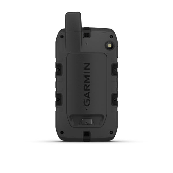
This durable, water-resistant handheld is tested to U.S. military standards and features a glove-friendly 5” touchscreen that’s 50% larger than previous Montana models.
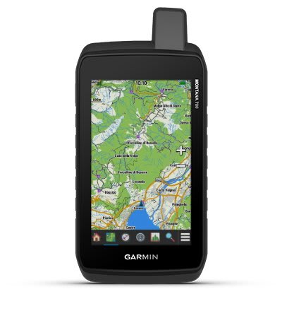
To navigate your adventures, use preloaded TopoActive Europe maps. View elevations, coastlines, rivers, landmarks and more.
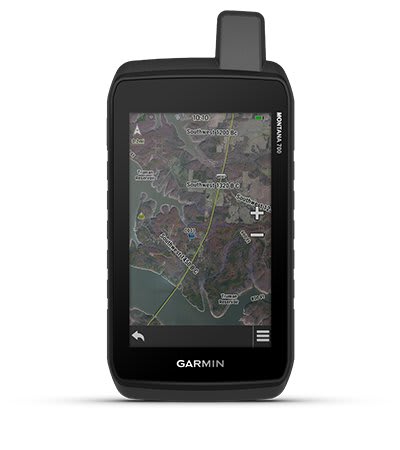
Use direct-to-device downloads of BirdsEye Satellite Imagery (no annual subscription required) to see photo-realistic views and create waypoints based on landmarks.
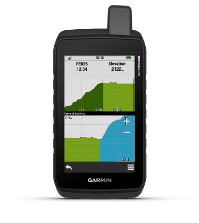
Navigate your next trail with ABC sensors, including an altimeter for elevation data, barometer to monitor weather and 3-axis electronic compass.
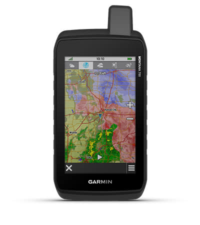
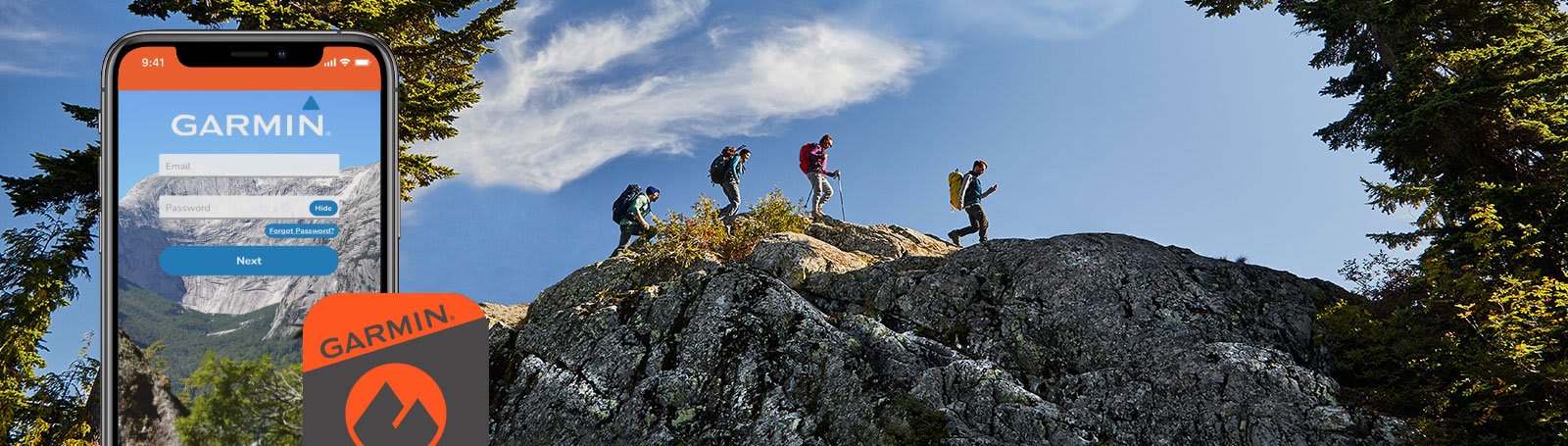
Use cellular connectivity 1 to access up-to-date Active Weather forecasts through the Garmin Connect™ app.
This Montana syncs with compatible Atemos series handhelds (sold separately) to help track dogs in the field.
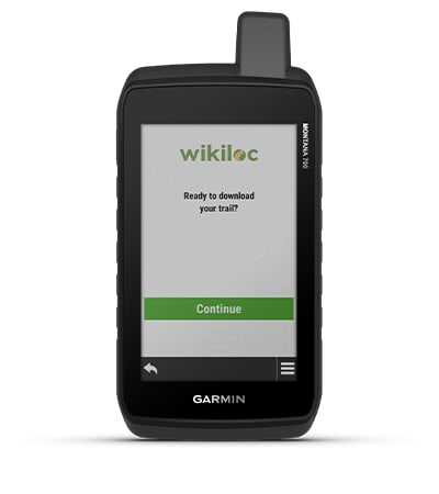
This preloaded app lets you easily download hiking, cycling and other Wikiloc trails shared by outdoor enthusiasts like you. Get a free 60-day Wikiloc Premium trial to try this and other exclusive features. Learn more.
Access to GPS, GLONASS and GALILEO satellite networks enables Montana ® 700 to track in more challenging environments than GPS alone.
The LiveTrack feature lets you wirelessly connect 1 your device with other compatible Garmin GPS users, so they can follow your tracks, routes, waypoints and adventures.
Trek far and wide off-grid. Use Expedition mode, an ultralow-power GPS reference, to keep Montana tracking for a week or more between recharges.
An internal, rechargeable lithium-ion battery pack provides more than 18 hours of battery life in GPS mode. It can also be powered with traditional AA batteries.
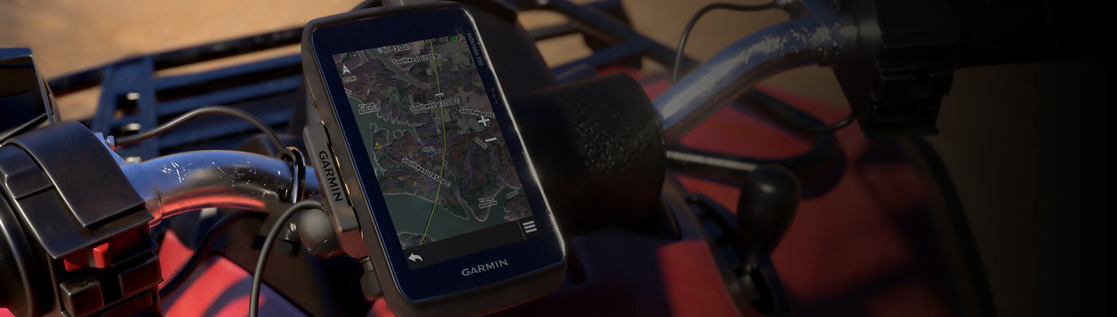
A variety of Montana handheld-compatible mounts (sold separately) lets you adapt your navigator for use on ATVs, boats, cars, motorcycles, RVs or other vehicles.
| Series | |
|---|---|
| inReach® Technology | No |
| 8 MP Camera | No |
General |
|
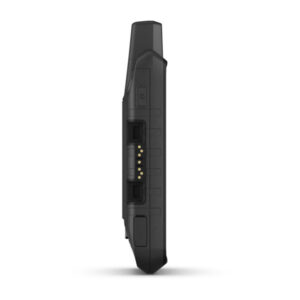
| Dimension | 8.76 x 18.30 x 3.27 cm |
|---|---|
| Touchscreen | |
| Display Size | 6.48 x 10.80 cm; 5″ diag (12.70 cm) |
| Display Resolution | 480 x 800 pixels |
| Display Type | WVGA transflective, dual orientation |
| Weight | 397 g with included lithium-ion battery pack |
| Battery type | rechargeable lithium-ion (included) or 3 AA batteries (not included); lithium recommended |
| Battery life | GPS Mode: up to 18 hoursExpedition Mode: up to 330 hours |
| Water rating | IPX7 |
| MIL-STD-810 | yes (thermal, shock, water, vibe) |
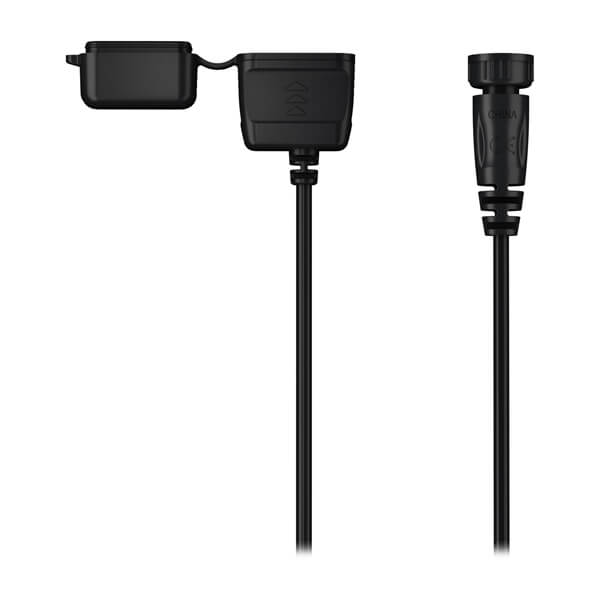
| Interface | High speed micro USB and NMEA 0183 compatible |
| Memory/history | 16 GB (user space varies based on included mapping) |
Maps & memory |
|
| Preloaded maps | Yes (TopoActive Europe) |
|---|---|
| Ability to add maps | |
| Basemap | |
| Automatic routing (turn by turn routing on roads) for outdoor activities | Yes (with optional mapping for detailed roads) |
| Map segments | 15000 |
| BirdsEye | Yes (direct to device) |
| Includes detailed hydrographic features (coastlines, lake/river shorelines, wetlands and perennial and seasonal streams) | |
| Includes searchable points of interests (parks, campgrounds, scenic lookouts and picnic sites) | |
| Displays national, state and local parks, forests, and wilderness areas | |
| STORAGE AND POWER CAPACITY | Yes (32 GB max microSD™ card) |
| Waypoints/favourites/locations | 10000 |
| Tracks | 250 |
| Navigation Track Log | 20000 points, 250 saved gpx tracks, 300 saved fit activities |
| Navigation Routes | 250, 250 points per route; 50 points auto routing |
| Rinex logging | |
Sensors |
|
| High-sensitivity receiver | |
|---|---|
| GPS | |
| GLONASS | |
| Galileo | |
| Barometric altimeter | |
| Compass | Yes (tilt-compensated 3-axis) |
| GPS compass (while moving) | |
Daily smart features |
|
| Connect IQ™ (downloadable watch faces, data fields, widgets and apps) | |
|---|---|
| Smart notifications on handheld | |
| VIRB® camera remote | |
| Compatible with Garmin Connect™ Mobile | |
| Active Weather | |
Safety and tracking features |
|
| LiveTrack | |
|---|---|
Outdoor recreation |
|
| Point-to-point navigation | |
|---|---|
| Area calculation | |
| Hunt/fish calendar | |
| Sun and moon information | |
| XERO™ Locations | |
| Geocaching-friendly | yes (Geocache Live) |
| Custom maps compatible | yes (500 custom map tiles) |
| Picture viewer | |
| inReach remote widget | |
| LED beacon flashlight | |
inReach® features |
|
| inReach remote compatible | |
|---|---|
Outdoor applications |
|
| Compatible with Garmin Explore™ app | |
|---|---|
| Garmin Explore website compatible | |
| Dog tracking | Yes (when paired to compatible dog track system) |
Connections |
|
| Connections Wireless Connectivity | Yes (Wi-Fi®, Bluetooth®, ANT+®) |
|---|---|
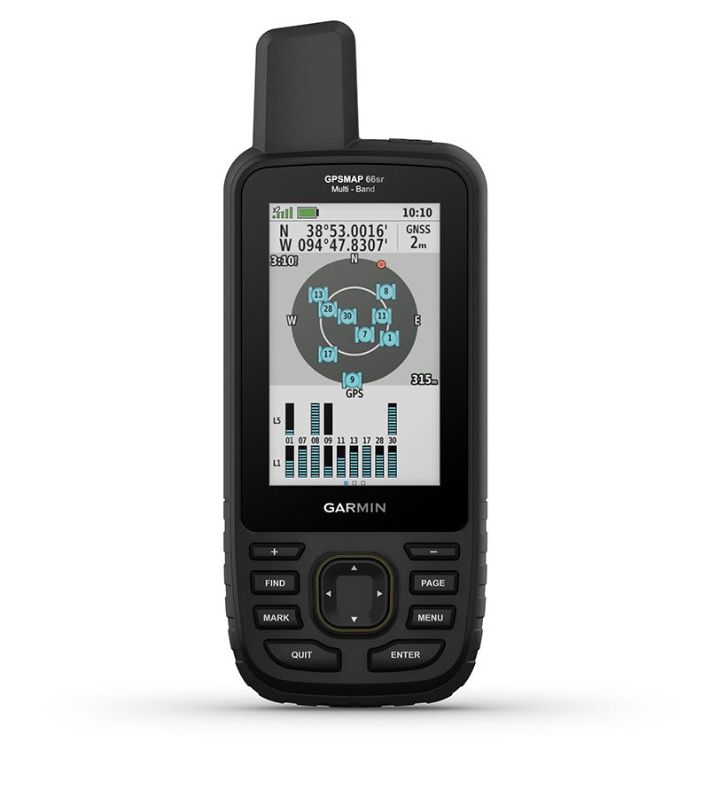
Multi-band/GNSS handheld with sensors and Topo Active Europe maps
Flame Red THIS PRODUCT CANNOT BE SHIPPED TO THE UNITED ARAB EMIRATES.
Multi-band/GNSS handheld with sensors and Topo Active Europe maps
Flame Red THIS PRODUCT CANNOT BE SHIPPED TO THE UNITED ARAB EMIRATES.
Multi-band/GNSS handheld with sensors and Topo Active Europe maps
Flame Red THIS PRODUCT CANNOT BE SHIPPED TO THE UNITED ARAB EMIRATES.